

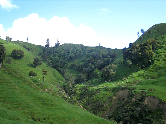
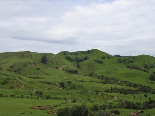
Ngapopohia is one of the numerous pa that have been recorded in the Tolaga Bay area, mostly located on the prominent hills and ridgelines which afforded excellent natural defences and provided commanding views of the surrounding landscape. These pa and the many other archaeological sites recorded in the Uawa region such as pit and terrace complexes, midden, gardens and urupa reflect the intensive occupation of this landscape by Maori from the time of initial Polynesian settlement approximately 700 years ago. Access to abundant food resources from the sea, rivers, inland forests and horticultural production (kumara) meant that a large population could be sustained. It has been estimated that the early Maori population of Tolaga Bay totalled approximately 1200; and the main iwi was Te Aitanga a Hauiti.
It has been stated that Ngapopohia was the site of a battle with Nga Puhi, who raided parts of the East Coast from Hawkes Bay and the Coromandel during the 1820s, but correspondence with Te Aitanga a Hauiti indicates that this is considered highly unlikely.
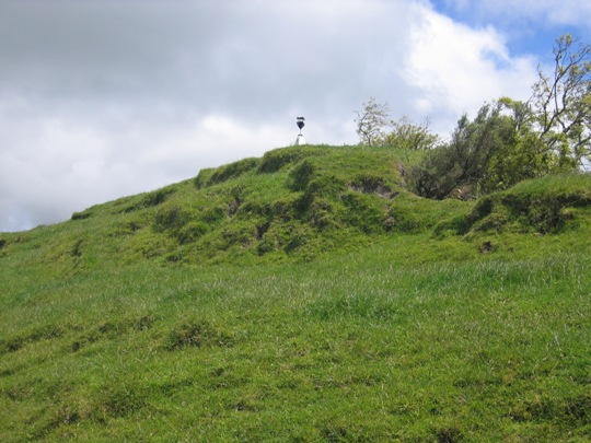
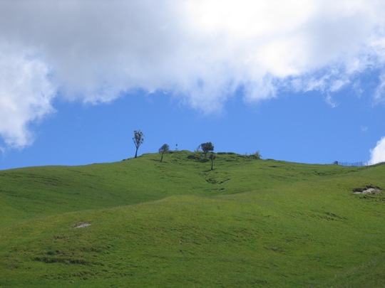
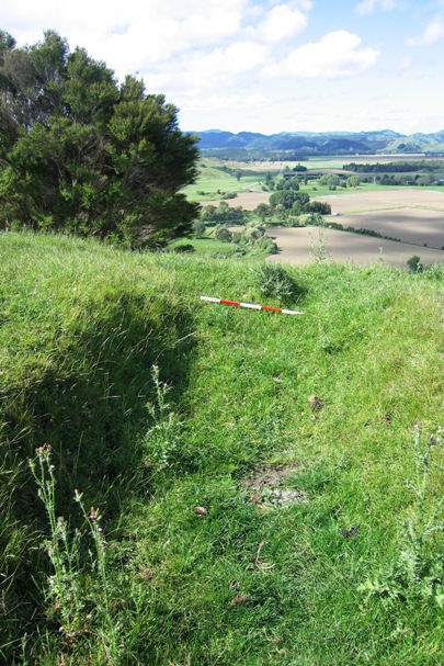
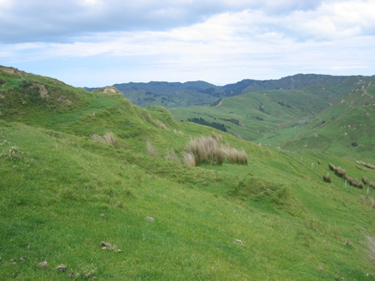
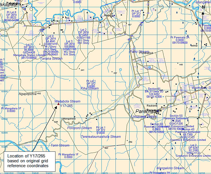
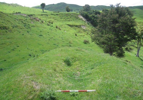
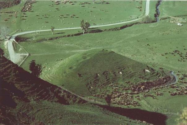
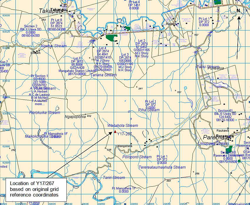
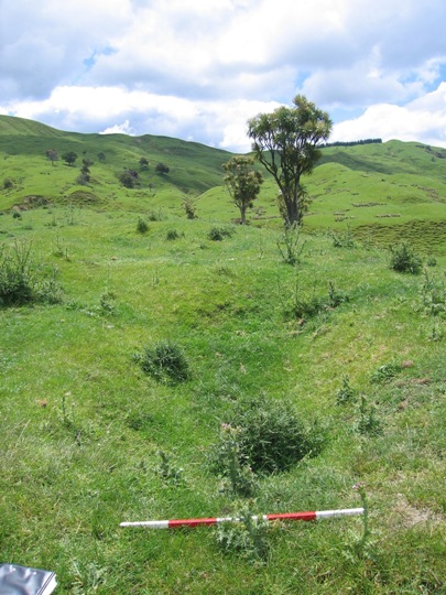
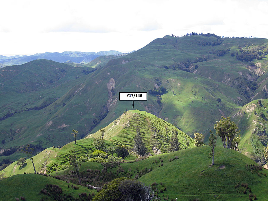
Ngapopohia is located in pasture on the peak of an east-west running ridgeline, at the site of Ngapopohia trig, 402 metres above sea level. Steep slopes to the north and east act as natural defences for the pa, which has strategic views to the surrounding landscape. Several other archaeological sites are located in the vicinity, including pa sites Y17/145 and Y17/146 on the ridgeline running southwest of Ngapopohia, between the Poroporo and Waitahota Streams.
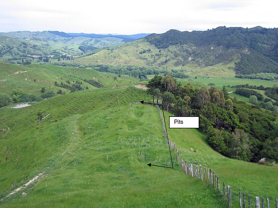
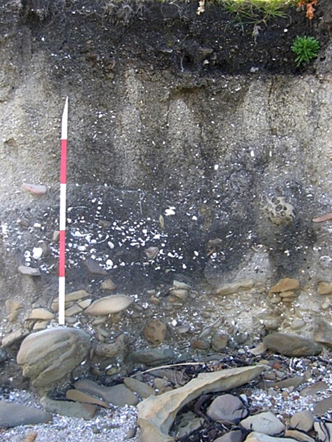
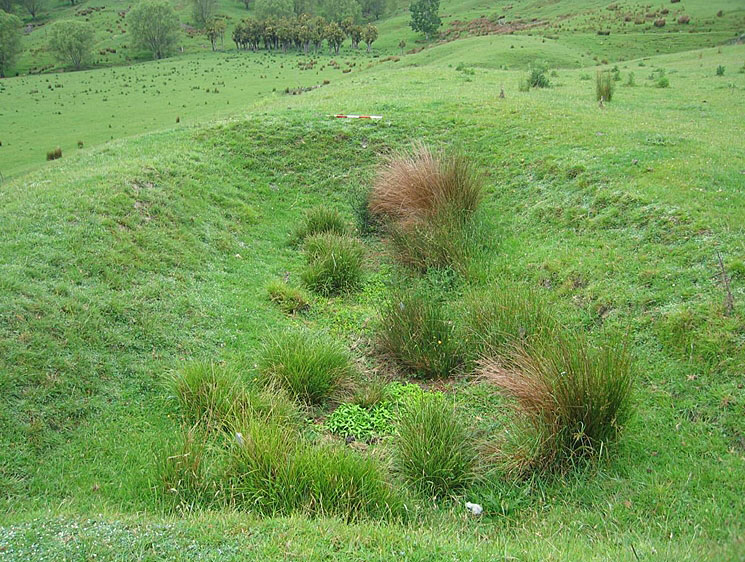
This pa was first recorded by archaeologist Kevin Jones during his archaeological survey work in the Whangara, Tolaga Bay and Uawa Catchment areas in 1982-1983. This survey work was undertaken to gain information about the nature of prehistoric settlement in this locality, and also to evaluate specific sites for registration under the Historic Places Act 1980. Jones recorded a terraced pa, with raised rim pits on some of the terraces, and completed a sketch plan of the site. With regards to the condition of the pa, he noted that it was under threat of stock erosion and slumping of the cliff face. Jones later estimated that the pa occupied a total of 70 metres of ridgeline, and could have sustained a population of 27 individuals.
In 2000, Ngapopohia was revisited by archaeologist Vanessa Tanner as part of the New Zealand Archaeological Association Site Recording Scheme Upgrade Project. Tanner found the site to be as originally illustrated, but severely eroded along the northeast edge of the site, at the cliff edge. Stock erosion was also noted as an issue. No major changes to the site were observed during a New Zealand Historic Places Trust site visit in late 2007.
Ngapopohia is one of the numerous pa recorded in the Tolaga Bay area, and is thought to date to the early 19th century. It is part of a much wider archaeological and cultural landscape that is of considerable significance to Te Aitanga a Hauiti, reflecting the intensive Maori occupation and settlement of the Tolaga Bay area since the 14th - 15th centuries AD.
List Entry Information
Status
Listed
List Entry Status
Historic Place Category 2
Access
Private/No Public Access
List Number
6543
Date Entered
25th September 1986
Date of Effect
25th September 1986
City/District Council
Gisborne District
Region
Gisborne Region
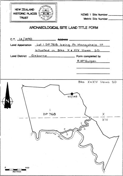
Extent of List Entry
Registration includes part of the land described as Pt Mangaheia 1F, Gisborne Land District, and the pa known as Ngapopohia (NZAA Site Record Number Y17/143) thereon.
Legal description
Pt Mangaheia 1F (RT GS5A/1496), Gisborne Land District
Location Description
Located on top of Ngapopohia Trig (see NZMS 260 Map for Y17: Te Karaka)
Status
Listed
List Entry Status
Historic Place Category 2
Access
Private/No Public Access
List Number
6543
Date Entered
25th September 1986
Date of Effect
25th September 1986
City/District Council
Gisborne District
Region
Gisborne Region
Extent of List Entry
Registration includes part of the land described as Pt Mangaheia 1F, Gisborne Land District, and the pa known as Ngapopohia (NZAA Site Record Number Y17/143) thereon.
Legal description
Pt Mangaheia 1F (RT GS5A/1496), Gisborne Land District
Location Description
Located on top of Ngapopohia Trig (see NZMS 260 Map for Y17: Te Karaka)
Construction Details
Type
Other
Description
Ngapopohia thought to have been occupied.
Period
Early nineteenth century
Construction Details
Type
Other
Description
Ngapopohia thought to have been occupied.
Period
Early nineteenth century
Historical and Associated Iwi / Hapū / Whānau
Public NZAA Number
Y17/143
Completion Date
8th March 2008
Report Written By
Joanna Wylie
Information Sources
Department of Conservation
Department of Conservation
New Zealand Journal of Archaeology
New Zealand Journal of Archaeology
New Zealand Archaeological Association (NZAA)
New Zealand Archaeological Association
Other Information
This place was identified as significant under previous legislation with different information requirements. It remains significant under the current legislation. There is opportunity under our legislation and policies to add to this information. Further information about this place may be available from the Lower Northern Office of Heritage New Zealand Pouhere Taonga. Iwi/ Hapu/ Whanau: Te Aitanga a Hauiti A fully referenced upgrade report is available from the NZHPT Lower Northern Area Office Please note that entry on the New Zealand Heritage List/Rarangi Korero identifies only the heritage values of the property concerned, and should not be construed as advice on the state of the property, or as a comment of its soundness or safety, including in regard to earthquake risk, safety in the event of fire, or insanitary conditions.
Current Usages
Uses: Agriculture
Specific Usage: Farm
Former Usages
General Usage: Maori
Specific Usage: Pā
Themes
Of Significance to Maori
Current Usages
Uses: Agriculture
Specific Usage: Farm
Former Usages
General Usage: Maori
Specific Usage: Pā
Themes
Of Significance to Maori
Location
Related listings
Sign up to hear more
Get the latest heritage news, features and events delivered
straight to your inbox.
