Mining the Shotover
The Shotover area had been part of Gilbert Rees' pastoral run, which he had taken up in the late 1850s. Thus he had only briefly been in occupation in what was later to be known as Queenstown when gold was discovered in the Wakatipu area. The government paid Rees £10,000 compensation for the loss of the run. Queenstown became the centre for exploration of the Wakatipu goldfield, and for European exploration further afield to places such as Milford Sound and St Martin's Bay.
The gold rush at the Shotover River began in November 1862 after Thomas Arthur and three others obtained 200oz of gold in eight days by washing the sand at what became known as Arthur's Point. After two months work they had recovered £4,000 worth of gold. The rush that followed was the largest that occurred in Otago. The area was remote and access difficult, making provisioning both troublesome and expensive.
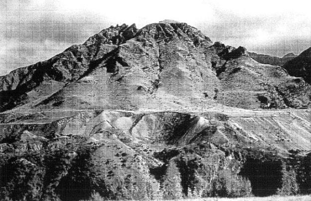
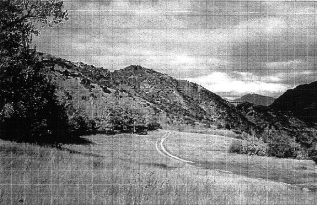
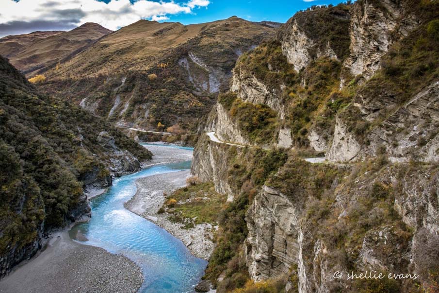
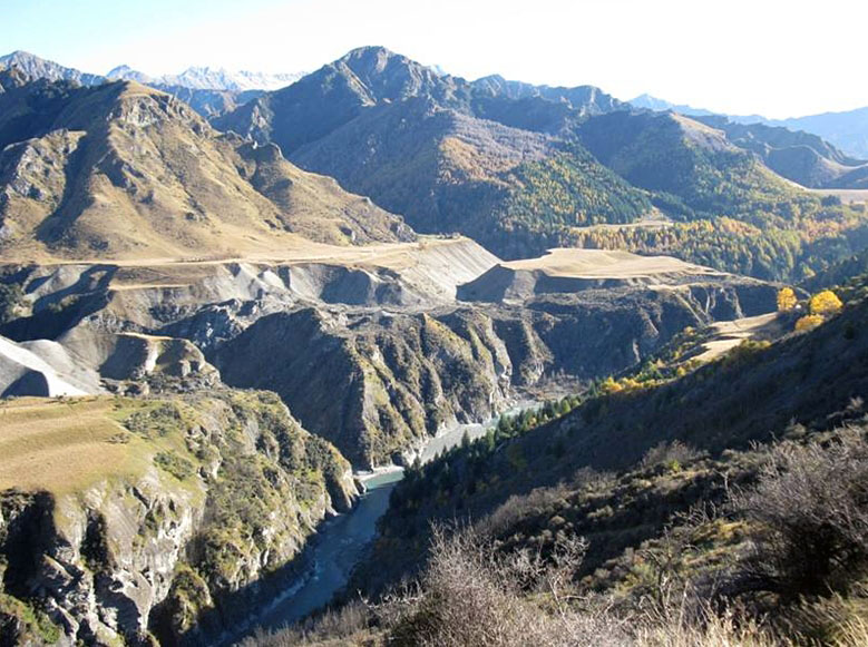
Before the end of 1863 many other gold-bearing creeks and gullies were discovered in the tributaries of the Shotover. The passage up the Shotover was difficult beyond Arthur's Point, owing to the almost continuous gorge for forty miles upstream. Despite the difficulties almost the whole of the river was prospected. One of the most important discoveries was that of Maori Point, about thirty miles above Queenstown, and close to the area where Wong Gong would later have his store. Named after its discoverers Dan Ellison and Hakaria Haeroa, Maori Point yielded rich returns. The chief of the areas opened up on the Shotover was Skippers. In February 1863 the Shotover was described in the Otago Witness as the richest river in the world.
The Shotover had good deposits in the gravel of the terraces on the banks of the river, but the banks rose so steeply that it was difficult to work them without endangering life. The authorities issued warnings to deter those who remained on their claims after the summer had passed.
The peak of the Wakatipu rush was in 1863. It ended with a bout of severe weather, followed by serious flooding which resulted in significant loss of life and mining equipment. The Shotover, its course blocked by avalanches of gravel, burst through the barriers, sending 10-20ft waves downstream. Those camping on the river beaches survived only by clambering up cliff faces. Snow followed flood, frost followed snow, and the result was enormous difficulties in packing supplies into the isolated fields leading to near starvation and some deaths from exposure. By 1865 alluvial miners had drifted to the West Coast goldfields, although quartz mining and dredging would continue for longer.
A small settlement developed at Maori Point. It was the only place on the Skippers Track where there was an area of open flat land. Its peak population was around 1863, and by 1864 the population was declining. One hotel (from an original 8 or so licensed premises) survived until 1900, serving those travelling the Skippers Road. A store and post office existed at Maori Point until around 1895, when a fire destroyed the buildings. Postal services moved to the hotel and continued until 1920.
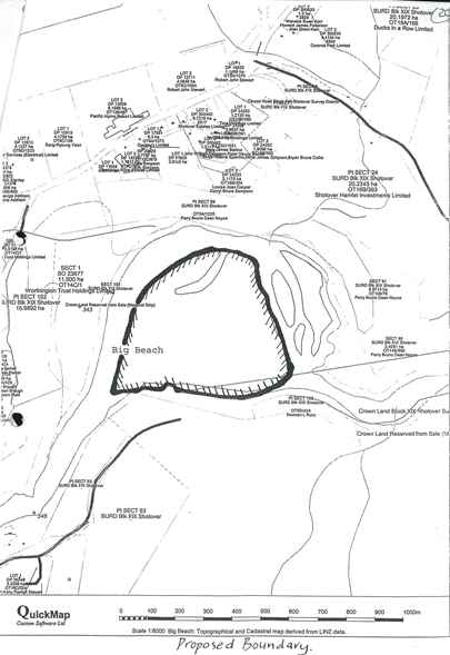
The first Chinese arrived in the Wakatipu District in 1868, going first to Big Beach at Arthurs Point. The Chinese population grew to 735 by mid 1870, only slightly less than the population of European miners. By 1871 there were more Chinese than European miners in the area.
Gold dredges operated at Maori Point in the first decade of the twentieth century. While mining declined in the late nineteenth and early twentieth century, there was a recovery in the form of large scale mining activities from 1934-1941.
Chinese Gardens and Stores in Central Otago
A notable feature of the Otago Goldfields just before the arrival of the Chinese had been the large number of storekeepers - 872 in early 1866. As the European miners left the Otago goldfields for the West Coast, these storekeepers must have expected some economic benefit from the arrival of Chinese miners. At first their wishes were realised, and businesses sprang up in areas that there were significant Chinese populations, such as Nevis. As the Chinese in some places opened their own stores, serving both Chinese and European customers, European traders became more hostile to the Chinese.
According to James Ng Chinese storekeepers have been largely forgotten. In Clyde the first Chinese store opened in 1868, and another long established business Sin Sing Lee store was started in 1872. Wong Gow had tea and general stores at Arrowtown and Cardrona in the 1870s. Wong Gong operated on the Skippers road in the 1880s. Most of the larger settlements had Chinese stores to support the Chinese mining population.
Chinese still frequented European shops if the prices were good. It was estimated that the Chinese increased the European trade in Lawrence by one third, and there was significant Chinese spending at for example Queenstown and Cromwell. The Chinese stores were small businesses. Ng notes that one small Chinese store was described as a single crowded room with a sacking door, and wall partitions made from packing cases. The main room of the Sun Kum Hop store in Lawrence measured only 14ft by 11ft. Most goldfield buildings were primitive however.
Small solitary stores in the goldfields provided provisions and company. The Skippers Chinese store closed in 1878. The storekeeper was a man called Wong Dep Feat, and he died in 1901.
Chinese orchards and gardens were also a notable feature in Central Otago. The gardens faced stiff European competition, and some public opposition. The antagonism was mitigated somewhat by the Chinese gardens having a reputation for lower prices and good service. In Central Otago Chinese gardeners usually formed a garden to supply their own needs, and then some expanded it to sell to the surrounding neighbourhood. According to James Ng local suppliers were to be found at Wetherstones, Macetown, Conroy's Gully, Bald Hill Flat and Round Hill. Other market gardens were associated with towns, including Waitahuna, Lawrence, Tapanui, Roxburgh, Cromwell, Queenstown and Riverton. Large market gardens were recorded at Beaumont, Butcher's Gully, Clyde, Ophir, Matakanui, Arrowtown and Palmerston. Chinese gardens were placed in goldfields where ever good opportunities existed.
Chinese commercial crops in inland Otago included potatoes, corn, cabbage, peas, gooseberries and strawberries. According to James Ng Chinese miners grew Chinese vegetables such as Chinese cabbage for their own use. One of the last large scale Chinese market gardens in Central Otago was that of Charlie Lock Chong (Ah Lock, Lok Tseung) at Matakanui.
Wong Gong
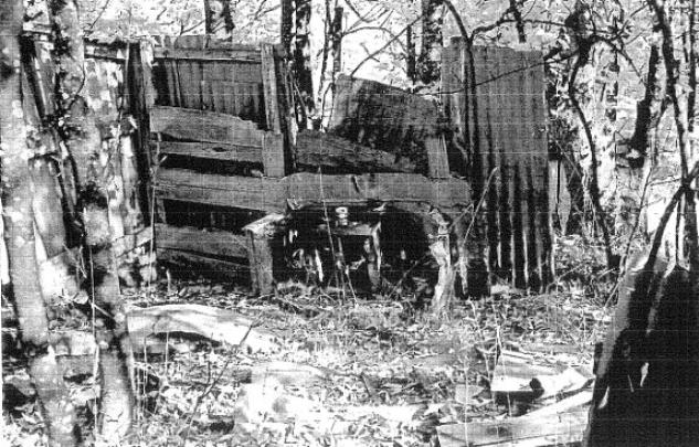
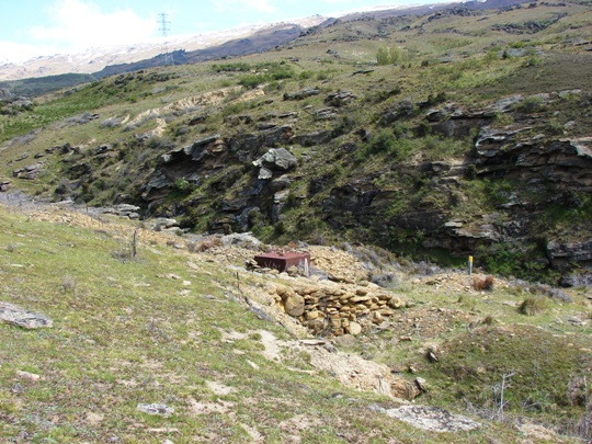
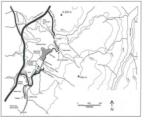
Wong Gong operated a store, garden and orchard at what became known as Wong Gong's Terrace, near Maori Point on the Skippers Road. Information regarding him and his business is sketchy, but the site provides an illustration of the isolation and transience of the Chinese goldfield community. Wong Gong (Wong Jay Noong) himself was of Taishan origin. He worked on other goldfields in Otago and was known to have kept a store at Butcher's Gully prior to his one at Skippers. He had apparently then invested in Bullendale, a mining area 10 kilometres north of Skippers, with heavy losses.
Wong Gong's store, garden and orchard were close to Wong Gong Creek on Wong Gong's Terrace at Maori Point on the Skippers Road, overlooking the Chinese river workings. These businesses were mentioned in the 1883-84 Wise's New Zealand Directory. Stone's Otago and Southland Directory lists Wong Gong as a Chinese interpreter in Arrowtown in 1888. Wong Gong's garden was mentioned in the New Zealand Presbyterian in March 1888. Alexander Don mentions Wong Gong's store in 1891, noting the premises could accommodate nine men.
Around 1901, as the numbers of the Chinese in the Shotover area declined sharply, he left his store and went mining in the Shotover. In April 1901 Alexander Don mentioned that there were only 15 men living singly or in small groups scattered along the riverbank.
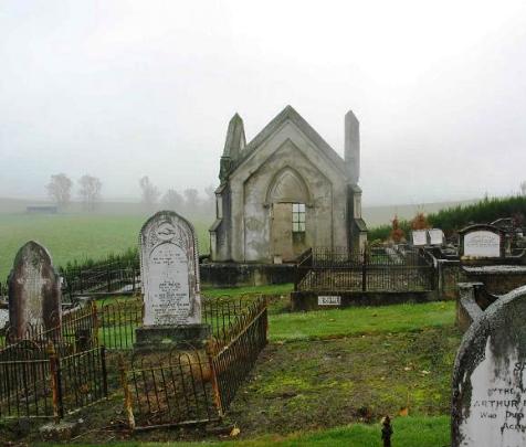
Wong Gong died in 1909 and is buried in Queenstown Cemetery.
Little is known about the land use on Wong Gong's Terrace after this date, other than the site being used during the Depression mining period in the 1930s, and its current site for the crib and as a viewing point for tourists on their way to Skippers.