

Hikatu is one of the numerous pa that have been recorded in the Tolaga Bay area, particularly in the Mangaheia Valley to the northwest of the township. They are mostly located on the prominent hills and ridgelines, which afforded excellent natural defences and provided commanding views of the surrounding landscape. Together with the many other archaeological sites recorded such as pit and terrace complexes, midden, gardens and urupa, they reflect the intensive occupation of this landscape by Maori from the time of initial Polynesian settlement approximately 700 years ago. A large population was able to be sustained by access to abundant food resources from the sea, rivers, inland forests and fertile soils, which were well-suited to kumara gardening. It has been estimated that the early Maori population of Tolaga Bay totalled approximately 1200; and the main iwi was Te Aitanga a Hauiti.
As detailed in John Laurie's Tolaga Bay: A History of the Uawa District, traditional Maori evidence states that Hikatu was associated with a battle over a stolen canoe in the early 1800s. This battle involved cousins Te Apaapa Maupeke ('Te Apaapa') and Ngarangimatatauira ('Ngarangi'), who was the father of Rangiuia - the last priest and teacher at Te Rawheoro, the renowned whare wananga (house of occult learning) at Tolaga Bay. Te Apaapa had brought a canoe containing seeds back to Uawa (Tolaga Bay), but worried that it would be burnt if kept with him, so asked Ngarangi to take the canoe to Hikatu where he felt it would be safer. However, Ngarangi decided to keep the canoe however, and sent for Pohuhu who was living at Te Karaka to the north of Tolaga Bay. Ngarangi asked Pohuhu to take the canoe up the Mangatuna Stream and hide it. When Te Apaapa sent a messenger to find out how the canoe was, Ngarangi replied that had been stolen and Pohuhu was blamed. Te Apaapa sent a message asking Pohuhu to return the canoe, but he responded by insulting the messenger.
Te Apaapa then notified the canoe's owner in Gisborne that it had been stolen, and the pa of Marama Tawhana was quickly constructed by Tawaputa and Ngati Kuranui, supporters of Pohuhu, as they knew that a fight would ensue. Tawaputa subsequently decided that he wished for the canoe to be returned to its rightful owners, Rongowhakaata (Gisborne-based iwi), but this was rejected by Ngati Kuranui. Rongowhakaata and Ngati Maru (a hapu of Rongowhakaata) travelled from Gisborne to Hikatu and an initial attack was made on Marama Tawhana, when it was discovered that Ngarangi was inside, having travelled via water from Hikatu. Three days passed and Ngarangi refused to leave, thereby revealing his true colours to Te Apaapa. Te Apaapa then decided to attack Marama Tawhana and Hikatu and both pa were sacked on the same day . Tawaputa had once again tried to restore peace by offering a red shawl to Te Apaapa, but he was only one of the chiefs in the war party and the attack continued. Some of the defeated from Marama Tawhana were taken to Gisborne as prisoners, but Tawaputa and a small group were taken and left at Te Upoko o te Ika (Cook's Cove).
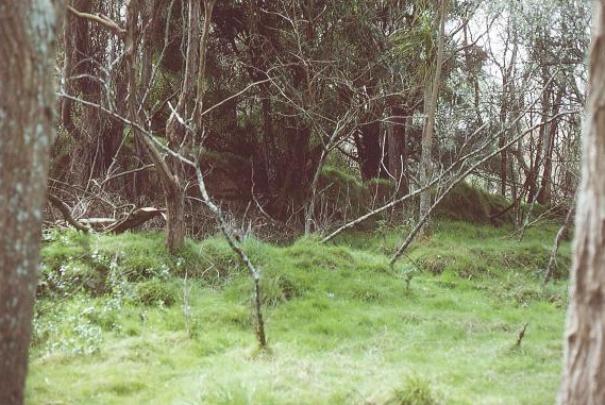
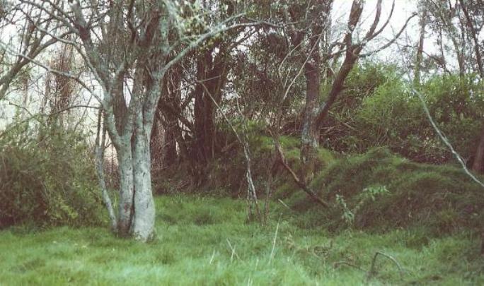
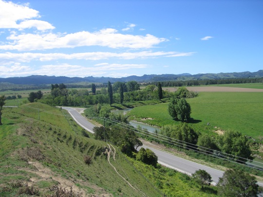
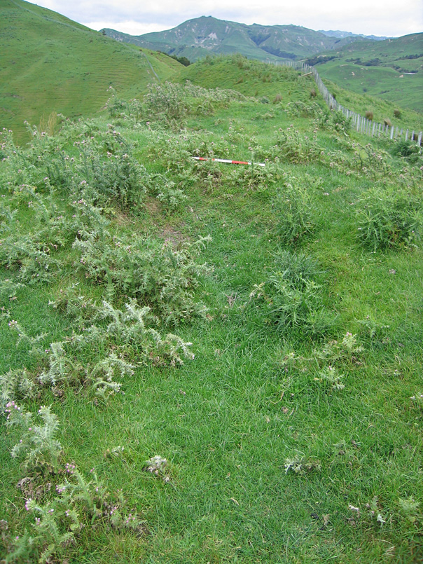
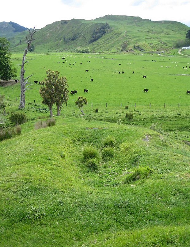
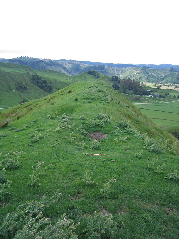
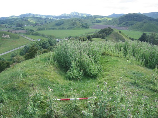
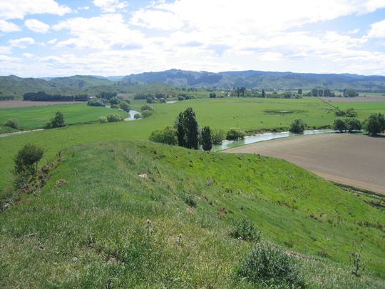
Unlike the other recorded pa in the Tolaga Bay area, which are mostly located on ridge tops, Hikatu (Z17/221) is located on the flat, on a distinct bend on the western side of the Mangaheia River. It is one of two recorded pa in the area which are situated on a river bend; the other being Marama Tawhana, to the north on the eastern bank of the Uawa River. The land where Hikatu is located was later used as an orchard, but is now overgrown with old orchard trees, grasses and long weeds. It is also currently used as a holding area for rams and a large pig. A number of other archaeological sites are located in the vicinity, such as the pit complex Z17/210 directly opposite Hikatu on the western side of Tauwhareparae Road, and midden site Z17/219 to the south along the western bank of the river. It has been estimated that Hikatu and the nearby pit complex Z17/210 could have supported a population of upwards of 100 individuals.
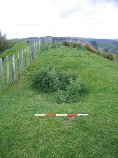
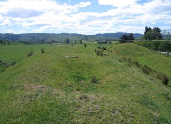
The site was first recorded by R. Sheppard on behalf of the New Zealand Historic Places Trust in 1982, possibly in association with the survey work undertaken by archaeologist Kevin Jones in the Whangara, Tolaga Bay and Uawa Catchment areas in 1982-1983. This survey work was undertaken to gain information about the nature of prehistoric settlement in this locality, and also to evaluate specific sites for registration under the Historic Places Act 1980. Sheppard recorded a double ditch and bank, about 100 metres into the old orchard from Tauwhareparae Road. The southern bank was one metre wide, with a drop of sixty centimetres to the north, and the northern bank was larger at 2.4 metres wide. It dropped to a depth of 2 metres on its southern side, and 1 metre on its northern side. Both banks measured approximately 22 metres in length, with the northern bank possibly extending further east across as shown on the sketch plan of the site. Sheppard commented that the site was likely to have been preserved as a result of the former land use (an orchard), which prevented in being ploughed like other land along the river banks.
Z17/221 was revisited by archaeologist Vanessa Tanner in 2000 as part of the New Zealand Archaeological Association Site Recording Scheme Upgrade Project. Tanner found that the site was covered in trees, weeds and long grasses and whilst the northern bank was still well-defined at the western end, the southern bank was less obvious. The old orchard trees were being cut down for firewood, and removal of the wood posed a potential threat to the site. The site was revisited by the New Zealand Historic Places Trust in November 2007, and the ditch and bank features were still visible amongst the vegetation such as dense thistles in certain areas. Rams and a large pig were being held on the site at the time of the visit, increasing the risk of further damage to the site through stock erosion.
Whilst the condition of Hikatu pa has deteriorated over time, it is still a place of considerable cultural and traditional value to Te Aitanga a Hauiti, and Rongowhakaata, Ngati Maru and Ngati Kuranui, being the site of a battle over Te Whirowhiro canoe in the early 1800s. It is also of particular archaeological note due to its unusual location on a river bend. In addition, Hikatu forms part of a much wider archaeological and cultural landscape which reflects the intensive Maori occupation and settlement of the Tolaga Bay area since the 14th - 15th centuries AD.
List Entry Information
Status
Listed
List Entry Status
Historic Place Category 2
Access
Private/No Public Access
List Number
6639
Date Entered
10th March 1986
Date of Effect
10th March 1986
City/District Council
Gisborne District
Region
Gisborne Region
Extent of List Entry
Registration includes part of the land described as Pt Paremata 3A Block, Gisborne Land District and the pa known as Hikatu (New Zealand Archaeological Association Site Record Number Z17/221) thereon.
Legal description
Pt Paremata 3A Block (RT GS1C/1268), Gisborne Land District
Construction Details
Start Year
1810
startYearCirca
Finish Year
1830
finishYearCirca
Type
Other
Description
1810s/ 1820s - Hikatu sacked by Te Apaapa and supporters from Rongowhakaata and Ngati Maru
Construction Details
Start Year
1810
startYearCirca
Finish Year
1830
finishYearCirca
Type
Other
Description
1810s/ 1820s - Hikatu sacked by Te Apaapa and supporters from Rongowhakaata and Ngati Maru
Historical and Associated Iwi / Hapū / Whānau
Public NZAA Number
Z17/221
Completion Date
8th March 2008
Report Written By
Joanna Wylie
Information Sources
Archives New Zealand (Wgtn)
Archives New Zealand (Wellington)
Department of Conservation
Department of Conservation
Laurie, 1991
John Laurie, Tolaga Bay: A History of the Uawa District, H.B. Williams Memorial Library, Gisborne, 1991.
New Zealand Journal of Archaeology
New Zealand Journal of Archaeology
New Zealand Archaeological Association (NZAA)
New Zealand Archaeological Association
Other Information
This place was identified as significant under previous legislation with different information requirements. It remains significant under the current legislation. There is opportunity under our legislation and policies to add to this information. Further information about this place may be available from the Lower Northern Office of Heritage New Zealand Pouhere Taonga. Iwi/ Hapu/ Whanau: Te Aitanga a Hauiti A fully referenced upgrade report is available from the NZHPT Lower Northern Area Office Please note that entry on the New Zealand Heritage List/Rarangi Korero identifies only the heritage values of the property concerned, and should not be construed as advice on the state of the property, or as a comment of its soundness or safety, including in regard to earthquake risk, safety in the event of fire, or insanitary conditions.
Current Usages
Uses: Agriculture
Specific Usage: Farm
Former Usages
General Usage: Maori
Specific Usage: Pā
Themes
Of Significance to Maori
Current Usages
Uses: Agriculture
Specific Usage: Farm
Former Usages
General Usage: Maori
Specific Usage: Pā
Themes
Of Significance to Maori
Location
Related listings
Sign up to hear more
Get the latest heritage news, features and events delivered
straight to your inbox.
