

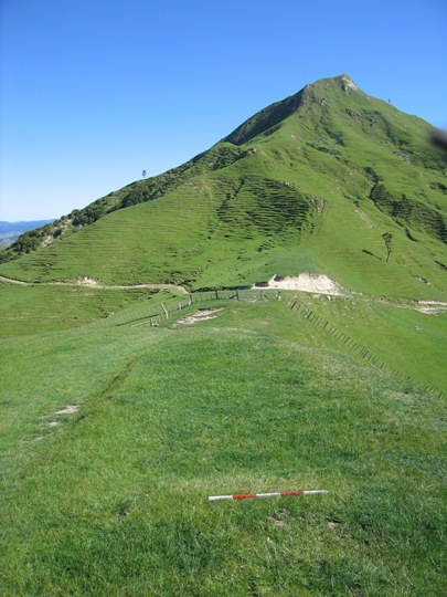
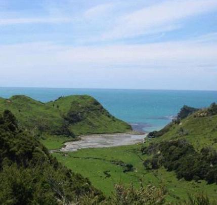
Te Raroa is one of the numerous pa that have been recorded in the Uawa region, mostly located on the prominent hills and ridgelines which afforded excellent natural defences and provided commanding views of the surrounding landscape. These pa and the many other archaeological sites recorded in the Uawa region such as pit and terrace complexes, midden, gardens and urupa reflect the intensive occupation of this landscape by Maori from the time of initial Polynesian settlement approximately 700 years ago. Access to abundant food resources from the sea, rivers, inland forests and bountiful horticultural production (kumara) meant that a large population could be sustained. It has been estimated that the early Maori population of Tolaga Bay totalled approximately 1200; and the main iwi was Te Aitanga a Hauiti.
Te Raroa was built in the time of Pourourangi, the eponymous ancestor of Ngati Porou, who lived during the 15th/ 16th centuries. The pa was occupied by many people including Porourangi and his younger brother Tahu Potiki (the eponymous ancestor of the Kai Tahu iwi) before his departure to Te Wai Pounamu (the South Island). Porourangi was very tapu and is believed to have participated in the structural design of the pa, which was built on the remains of previous settlements, rather than its actual construction.
There are differing versions of the meaning of the name 'Te Raroa'; it has been said the pa was named after a man - Raroa, but Te Raroa has also been translated as meaning the 'the long day'. Te Raroa was also one of the main fighting pa of Te Whakatatare-o-te-rangi, the ruling Te Aitanga a Hauiti ariki at the time of Captain Cook's visit to Cook's Cove in 1769. Te Raroa was one of the most heavily occupied pa in the wider East Coast region, and large numbers of people were still found to be living at the pa into the 18th and early 19th centuries.
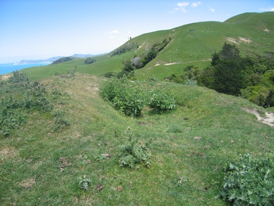
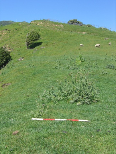
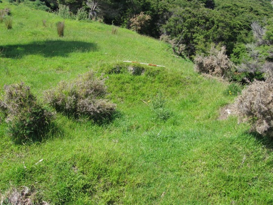
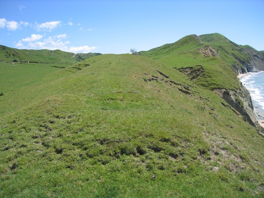
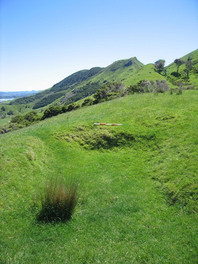
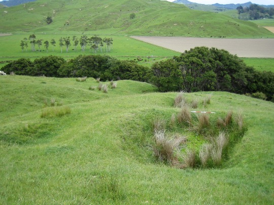
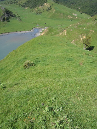
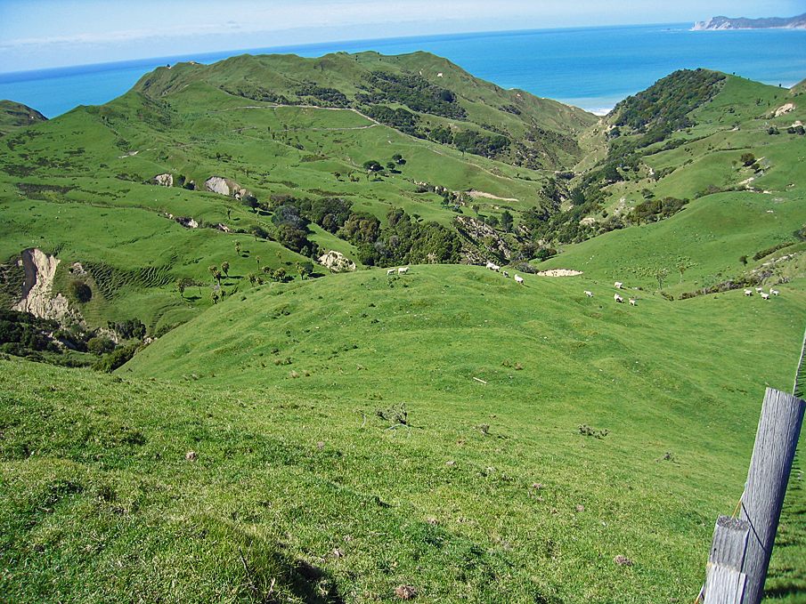
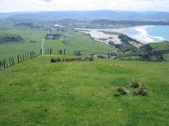
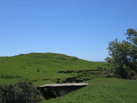
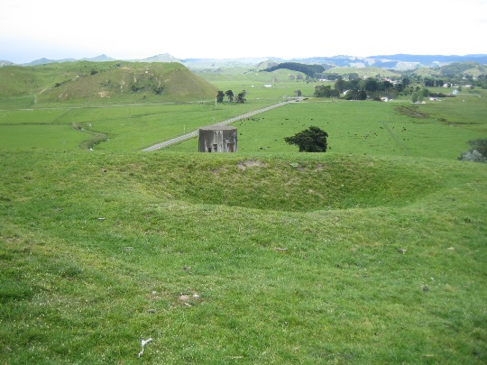
The south-western part of Te Raroa (Z17/252) is located approximately 300 metres east of the end of Shelton Road on the western boundary of the Station. It extends for approximately 150-200 metres along the ridgeline, and is currently in pasture, with some thistle coverage along the top part of the pa. It is grazed by cattle and sheep and a farm track runs beneath the south-western end of the site.
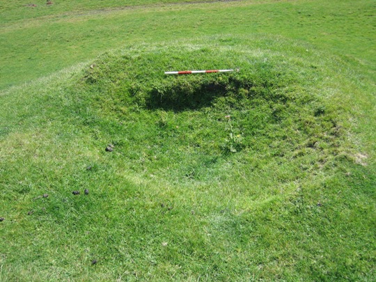
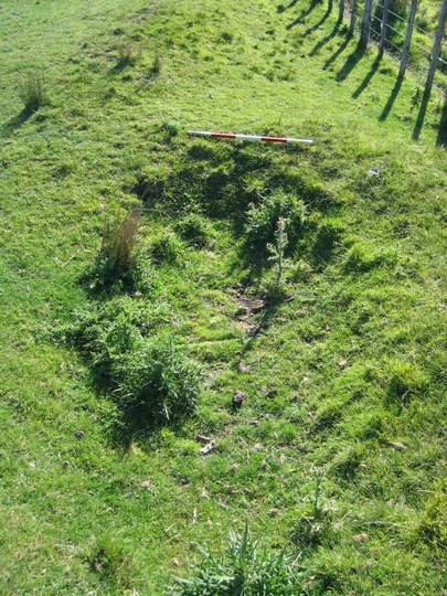
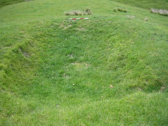
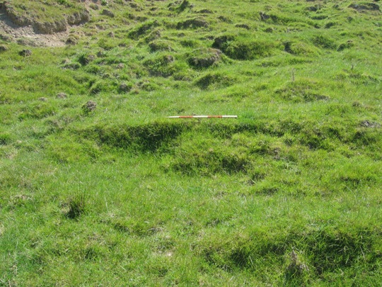
Z17/252 was first recorded by archaeologist Kevin Jones during his archaeological survey work in the Whangara, Tolaga Bay and Uawa catchment areas in 1982-1983. This survey work was undertaken to gain information about the nature of prehistoric settlement in this locality, and also to evaluate specific sites for registration under the Historic Places Act 1980. Jones described the site as a substantial pa with artificial defences (an infilled ditch) at either, and numerous terraces and raised rim pits (for storing kumara) to the interior. A section of lateral terracing was also noted along both sides of the pa, and it was considered that this terracing was probably for defensive purposes. Jones later estimated that the pa could have sustained a population of 132.
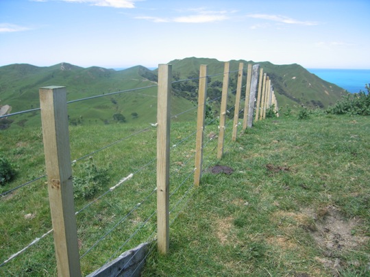
Z17/252 was revisited in 2000 by archaeologist Vanessa Tanner as part of the New Zealand Archaeological Association Site Recording Scheme Upgrade Project. Tanner noted that the pa was as originally recorded, although some features were no longer as clearly defined, notably at the north-eastern end of the site. A fence line had been put through the site since it was first recorded, which may have caused damage to archaeological features, and cattle were also tramping the site.
A 2007 NZHPT site visit revealed no major changes to the site, although a new fence line had been erected running down from the ridge top in a south-easterly direction, which may have caused some damage to archaeological features. It was also noted that cattle continue to graze the site, causing ongoing stock damage as observed at the south-western end of the pa.
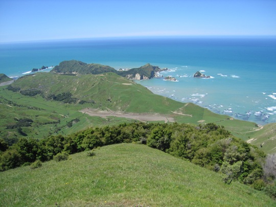
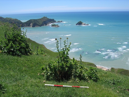
There are a number of pa in the Uawa area, but site Z17/252 is a substantial pa, and it is in good condition overall. It is a visually impressive site and provides expansive views of the surrounding area. Z17/252 is of considerable cultural, traditional and spiritual significance to local iwi - Te Aitanga a Hauiti, as it forms the south-western part of Te Raroa, one of the main fighting pa of Te Whakatatare-o-te-rangi - the ruling chief at the time of Captain Cook's arrival in Tolaga Bay in 1769..This connection with the arrival of Captain Cook is of historical importance, as is the fact that Te Raroa was occupied through into the early 19th century.
List Entry Information
Status
Listed
List Entry Status
Historic Place Category 2
Access
Private/No Public Access
List Number
6644
Date Entered
10th March 1986
Date of Effect
10th March 1986
City/District Council
Gisborne District
Region
Gisborne Region
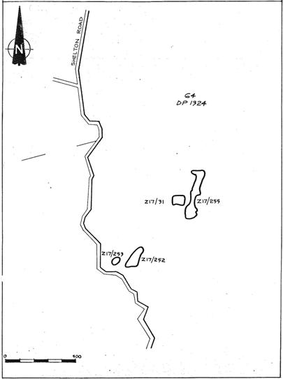
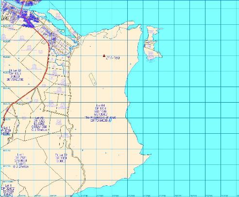
Extent of List Entry
Registration includes part of the land described as Lot 64 DP 1324, Gisborne Land District and the structure known as Te Raroa (New Zealand Archaeological Association Site Record Number Z17/252) thereon.
Legal description
Lot 64 DP 1324 (RT GS126/62), Gisborne Land District
Status
Listed
List Entry Status
Historic Place Category 2
Access
Private/No Public Access
List Number
6644
Date Entered
10th March 1986
Date of Effect
10th March 1986
City/District Council
Gisborne District
Region
Gisborne Region
Extent of List Entry
Registration includes part of the land described as Lot 64 DP 1324, Gisborne Land District and the structure known as Te Raroa (New Zealand Archaeological Association Site Record Number Z17/252) thereon.
Legal description
Lot 64 DP 1324 (RT GS126/62), Gisborne Land District
Historical and Associated Iwi / Hapū / Whānau
Public NZAA Number
Z17/252
Completion Date
9th March 2008
Report Written By
Joanna Wylie
Information Sources
Department of Conservation
Department of Conservation
New Zealand Journal of Archaeology
New Zealand Journal of Archaeology
New Zealand Archaeological Association (NZAA)
New Zealand Archaeological Association
Historic Places in New Zealand
Historic Places in New Zealand
Other Information
This place was identified as significant under previous legislation with different information requirements. It remains significant under the current legislation. There is opportunity under our legislation and policies to add to this information. Further information about this place may be available from the Lower Northern Office of Heritage New Zealand Pouhere Taonga. Iwi/ Hapu/ Whanau: Te Aitanga a Hauiti A fully referenced upgrade report is available from the NZHPT Lower Northern Area Office Please note that entry on the New Zealand Heritage List/Rarangi Korero identifies only the heritage values of the property concerned, and should not be construed as advice on the state of the property, or as a comment of its soundness or safety, including in regard to earthquake risk, safety in the event of fire, or insanitary conditions.
Current Usages
Uses: Agriculture
Specific Usage: Farm
Former Usages
General Usage: Maori
Specific Usage: Pā
Themes
Of Significance to Maori
Current Usages
Uses: Agriculture
Specific Usage: Farm
Former Usages
General Usage: Maori
Specific Usage: Pā
Themes
Of Significance to Maori
Location
Related listings
Sign up to hear more
Get the latest heritage news, features and events delivered
straight to your inbox.
