

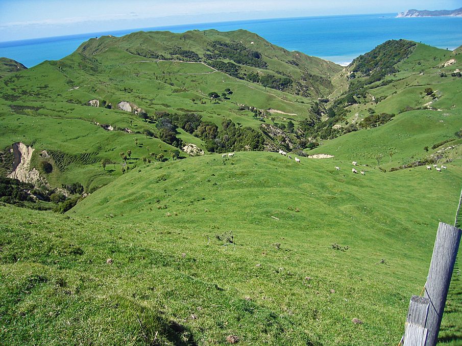
Pit sites and the many other recorded archaeological sites including pa, midden, gardens and urupa reflect the intensive Maori occupation of the Tolaga Bay from the time of initial Polynesian settlement approximately 700 years ago. Access to abundant food resources from the sea, rivers, inland forests and horticultural production (kumara) meant that a large population could be sustained. It has been estimated that the early Maori population of Tolaga Bay totalled approximately 1200; and the main iwi was Te Aitanga a Hauiti.
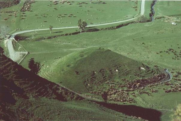
Pit and pit/ terrace sites are very common in Tolaga Bay, and demonstrate the importance of horticulture to Tolaga Bay's earliest inhabitants. The Bay's fertile soils and temperate climate were well suited to kumara gardening, and the pits were used for storing harvested kumara over the winter months. Rectangular storage pits (which were once roofed with a layer of earth), are more prevalent than the underground storage pits found elsewhere in New Zealand, a pattern attributed to the harder substrate of the soil in this area. They are in fact the most common archaeological site type in Tolaga Bay, and are found along the river banks and on the rolling hills to the south of the Bay. They are generally located or ridge crests, in lines from end to end, or in clusters on knolls or terraces, as with site Z17/280.
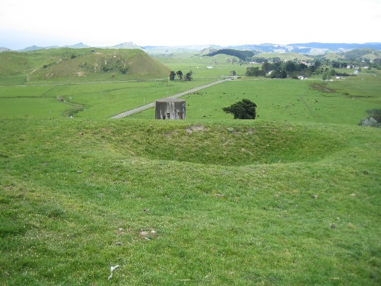
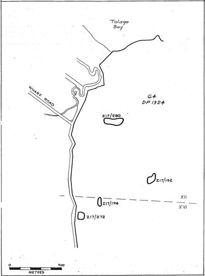
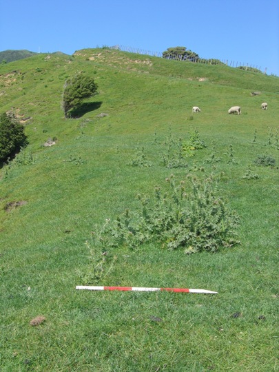
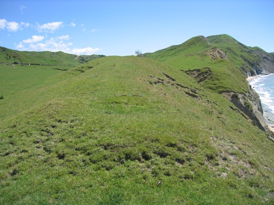
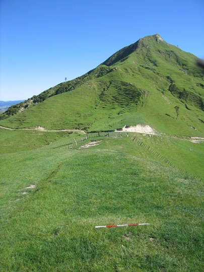
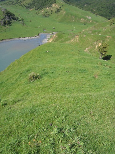
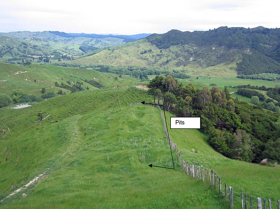
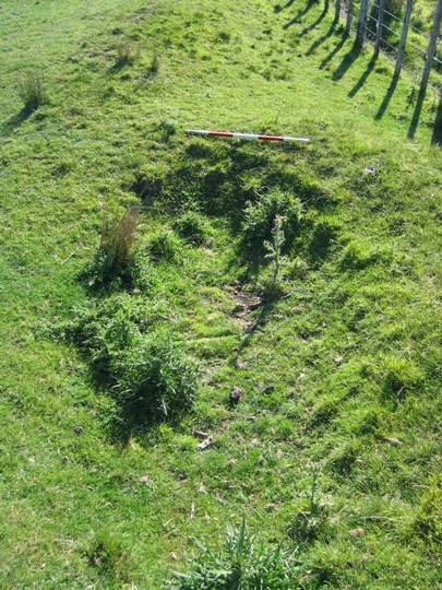
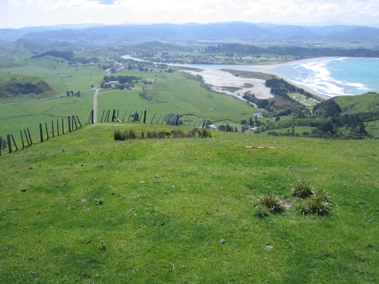
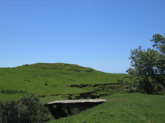
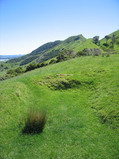
Pit site Z17/280 is located in pasture (with some tussocks) at the northern end of a broad knoll approximately 300 metres south of the Titirangi Station woolshed. A water tank is located immediately to the west of the site. A number of other archaeological sites are located in the vicinity, such as pit site Z17/330.
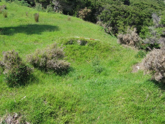
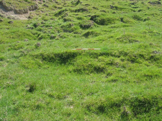
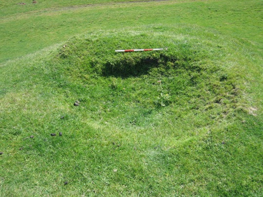
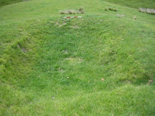
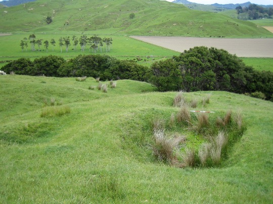
This site was first recorded by A. Nowakowski in 1983, who observed six pits in total: three pits measuring 3 metres x 2 metres, two pits measuring 2 metres x 1 metre and one larger pit measuring 6 metres x 3 metres. Nowakowski recorded that half the pits were very eroded, only showing as vague impressions.
Pit site Z17/280 was revisited by archaeologist Vanessa Tanner in 2000 as part of the New Zealand Archaeological Association Site Recording Scheme Upgrade Project. Tanner described the site as 'poor, vague, trampled', and at the time of the visit the area was being used for holding sheep. Tanner completed a sketch map of the site showing six pits and one possible pit or terrace. One of the pits (measuring 5 metres x 1 metre) was located approximately 100 metres southwest of the others, at the intersection of two fence lines. A drain also ran between two raised rim pits at the northern end of the knoll.
The site was revisited by the New Zealand Historic Places Trust in November 2007, and no major changes were observed. Stock damage was an ongoing threat to the site, but archaeological features were still visible, particularly the large pit on the edge of the knoll near the water tank, which is very clearly defined. In addition, some possible terracing was observed on the ridge behind this pit.
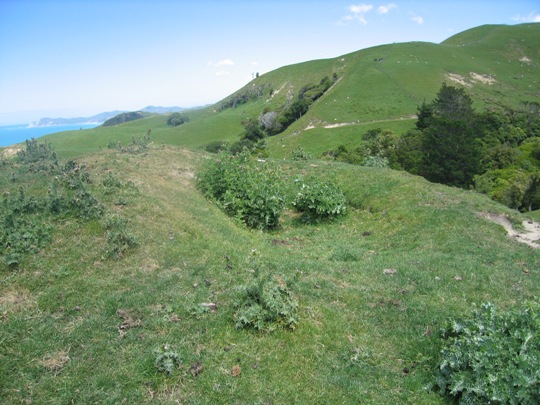
Z17/280 is one of the numerous pit and pit/terrace sites recorded in the Tolaga Bay area and it forms part of a dense archaeological and cultural landscape that is of considerable significance to Te Aitanga a Hauiti. This landscape reflects the intensive Maori occupation and settlement of the Tolaga Bay area since the 14th - 15th centuries A.D., and the important role that horticulture played in this.
List Entry Information
Status
Listed
List Entry Status
Historic Place Category 2
Access
Private/No Public Access
List Number
6651
Date Entered
10th March 1986
Date of Effect
10th March 1986
City/District Council
Gisborne District
Region
Gisborne Region
Extent of List Entry
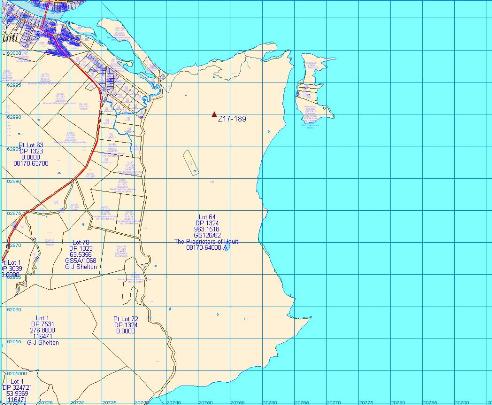
The registration includes part of the land described as Lot 64 DP 1324, Gisborne Land District and the archaeological site Z17/280 (New Zealand Archaeological Association Site Record Number).
Legal description
Lot 64 DP 1324 (RT GS126/62), Gisborne Land District
Status
Listed
List Entry Status
Historic Place Category 2
Access
Private/No Public Access
List Number
6651
Date Entered
10th March 1986
Date of Effect
10th March 1986
City/District Council
Gisborne District
Region
Gisborne Region
Extent of List Entry
The registration includes part of the land described as Lot 64 DP 1324, Gisborne Land District and the archaeological site Z17/280 (New Zealand Archaeological Association Site Record Number).
Legal description
Lot 64 DP 1324 (RT GS126/62), Gisborne Land District
Historical and Associated Iwi / Hapū / Whānau
Public NZAA Number
Z17/280
Completion Date
10th March 2008
Report Written By
Joanna Wylie
Information Sources
Department of Conservation
Department of Conservation
New Zealand Journal of Archaeology
New Zealand Journal of Archaeology
New Zealand Archaeological Association (NZAA)
New Zealand Archaeological Association
Historic Places in New Zealand
Historic Places in New Zealand
Other Information
This place was identified as significant under previous legislation with different information requirements. It remains significant under the current legislation. There is opportunity under our legislation and policies to add to this information. Further information about this place may be available from the Lower Northern Office of Heritage New Zealand Pouhere Taonga. Iwi/ Hapu/ Whanau: Te Aitanga a Hauiti A fully referenced upgrade report is available from the NZHPT Lower Northern Area Office Please note that entry on the New Zealand Heritage List/Rarangi Korero identifies only the heritage values of the property concerned, and should not be construed as advice on the state of the property, or as a comment of its soundness or safety, including in regard to earthquake risk, safety in the event of fire, or insanitary conditions.
Current Usages
Uses: Agriculture
Specific Usage: Farm
Themes
Of Significance to Maori
Current Usages
Uses: Agriculture
Specific Usage: Farm
Themes
Of Significance to Maori
Location
Related listings
Sign up to hear more
Get the latest heritage news, features and events delivered
straight to your inbox.
