

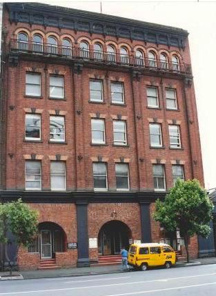
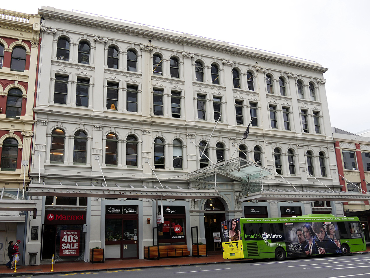
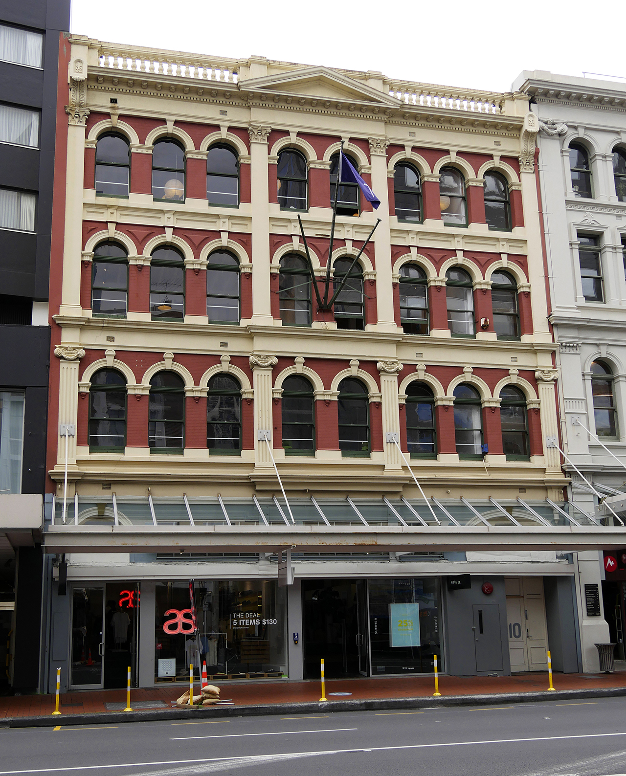
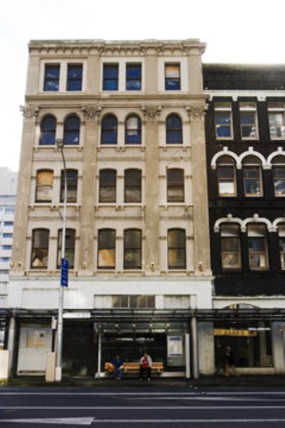
The warehouses and stores erected in Customs St to provide storage, distribution and export-import of goods served a variety of businesses.
Proximity to Queen St (Auckland's main street and principal shopping thoroughfare) enhanced the servicing of retail establishments and heightened
the profile of general and fancy goods merchants and brand products. Nearby, the railway station was of major importance in the distribution of these goods. The majority of the buildings within the Customs St area have their origins in the economic boom of the early 1880s or the economic revival of the late 1890's following an intervening depression.
List Entry Information
Status
Listed
List Entry Status
Historic Area
Access
Able to Visit
List Number
7160
Date Entered
16th December 1994
Date of Effect
16th December 1994
City/District Council
Auckland Council
Region
Auckland Council
Extent of List Entry
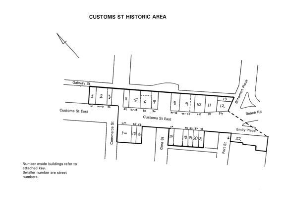
Buildings along both sides of Customs St East, and into Britomart place & Fort St. Buildings include 10, 14-18, 20, 22, 26-28, 30, 34, 36-38, 40-46, 47, 48, 50, 54, 55, 57, 69, 79, 85, 87, 89 Customs St East; 2 Britomart Place; 89 Fort St.. The area extends continuously along the northern side of Customs Street East from numbers 10 to 54 (inclusive) and includes number 2 Britomart Place. With the exception of numbers 20, 26-28, 30 and 34, these buildings extend back to Galway Street, a narrow lane which runs parallel to Customs Street from Queen Elizabeth Square to Britomart Place. Commerce and Gore Streets divide the northern side of the street into three blocks. On the opposite (souther) side of the street, buildings have frontage to 47, 55, 57, 69, and 79 to 89 Customs Street East; and 89 Fort Street.
Status
Listed
List Entry Status
Historic Area
Access
Able to Visit
List Number
7160
Date Entered
16th December 1994
Date of Effect
16th December 1994
City/District Council
Auckland Council
Region
Auckland Council
Extent of List Entry
Buildings along both sides of Customs St East, and into Britomart place & Fort St. Buildings include 10, 14-18, 20, 22, 26-28, 30, 34, 36-38, 40-46, 47, 48, 50, 54, 55, 57, 69, 79, 85, 87, 89 Customs St East; 2 Britomart Place; 89 Fort St.. The area extends continuously along the northern side of Customs Street East from numbers 10 to 54 (inclusive) and includes number 2 Britomart Place. With the exception of numbers 20, 26-28, 30 and 34, these buildings extend back to Galway Street, a narrow lane which runs parallel to Customs Street from Queen Elizabeth Square to Britomart Place. Commerce and Gore Streets divide the northern side of the street into three blocks. On the opposite (souther) side of the street, buildings have frontage to 47, 55, 57, 69, and 79 to 89 Customs Street East; and 89 Fort Street.
Why is this place significant?
Cultural Significance
This historic area was registered under the Historic Places Act 1993. The following text is from the original Recommendation for Registration report considered by the NZHPT Board at the time of registration. Cultural/Social: The brick warehouses and stores of permanent materials and imposing appearance erected in Customs St East contributed to a perception by Auckland residents that the town was developing into a prosperous commercial centre.
Historic Significance
Historical Significance or Value This historic area was registered under the Historic Places Act 1993. The following text is from the original Recommendation for Registration report considered by the NZHPT Board at the time of registration. Historical: The importance of the waterfront in the nineteenth and early twentieth century as the city's point of commercial contact with the rest of the colony and the world is reflected in the warehouse buildings which survive from the period. This large group of warehouses with their impressive facades represent Auckland's growth in harbour trade and increased prosperity at the turn of the century.
Physical Significance
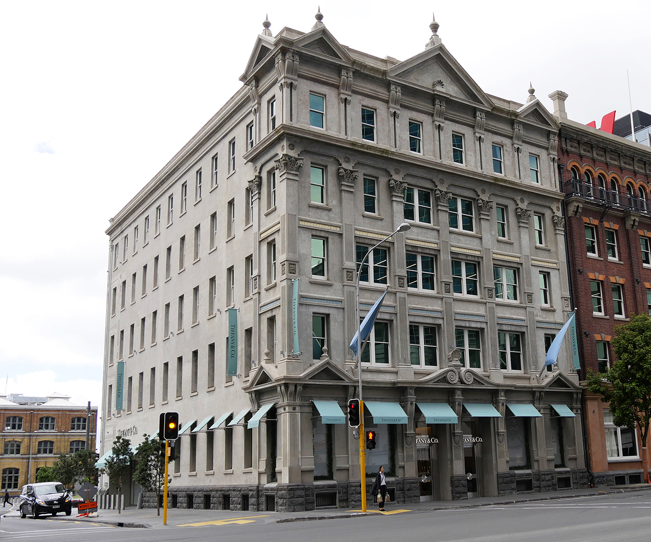
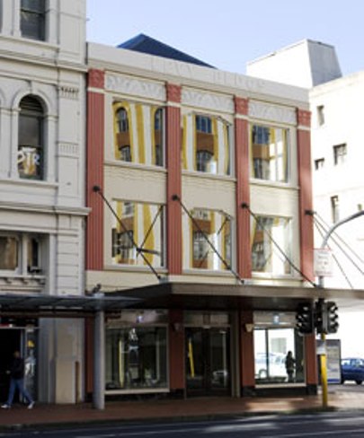
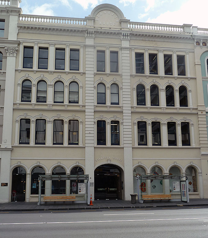
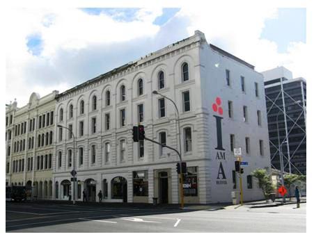
This historic area was registered under the Historic Places Act 1993. The following text is from the original Recommendation for Registration report considered by the NZHPT Board at the time of registration. Architectural: Buildings on the northern side of Customs St East may be generally described as a group of multi-storeyed merchants' warehouses, on average four to five storeys in height, which were predominantly built around the turn of the century or shortly thereafter. Functional in plan, simple in form and notable for classical renaissance motifs in their street aspect, the warehouses combine to form a continuous street facade on the loose Italianate style, a style favoured by the commercial aristocracy for the prestige it bestowed. On the southern side, the buildings are more varied in age, scale and character and are interspersed with buildings of more modern origin. Aesthetic: The warehouse precinct makes a significant contribution to the visual amenities of Auckland City's downtown area. The significance of the Customs St warehouses lies not only in their contribution to the character of the downtown commercial area but also because of their association with the grand houses of Princes St. For example, "Pembridge" at 31 Princes St was the home of A.H. Nathan whose five storeyed warehouse stands at 42 Customs St East.
Why is this place significant?
Cultural Significance
This historic area was registered under the Historic Places Act 1993. The following text is from the original Recommendation for Registration report considered by the NZHPT Board at the time of registration. Cultural/Social: The brick warehouses and stores of permanent materials and imposing appearance erected in Customs St East contributed to a perception by Auckland residents that the town was developing into a prosperous commercial centre.
Historic Significance
Historical Significance or Value This historic area was registered under the Historic Places Act 1993. The following text is from the original Recommendation for Registration report considered by the NZHPT Board at the time of registration. Historical: The importance of the waterfront in the nineteenth and early twentieth century as the city's point of commercial contact with the rest of the colony and the world is reflected in the warehouse buildings which survive from the period. This large group of warehouses with their impressive facades represent Auckland's growth in harbour trade and increased prosperity at the turn of the century.
Physical Significance
This historic area was registered under the Historic Places Act 1993. The following text is from the original Recommendation for Registration report considered by the NZHPT Board at the time of registration. Architectural: Buildings on the northern side of Customs St East may be generally described as a group of multi-storeyed merchants' warehouses, on average four to five storeys in height, which were predominantly built around the turn of the century or shortly thereafter. Functional in plan, simple in form and notable for classical renaissance motifs in their street aspect, the warehouses combine to form a continuous street facade on the loose Italianate style, a style favoured by the commercial aristocracy for the prestige it bestowed. On the southern side, the buildings are more varied in age, scale and character and are interspersed with buildings of more modern origin. Aesthetic: The warehouse precinct makes a significant contribution to the visual amenities of Auckland City's downtown area. The significance of the Customs St warehouses lies not only in their contribution to the character of the downtown commercial area but also because of their association with the grand houses of Princes St. For example, "Pembridge" at 31 Princes St was the home of A.H. Nathan whose five storeyed warehouse stands at 42 Customs St East.
Historical and Associated Iwi / Hapū / Whānau
Other Information
A copy of the original report is available from the NZHPT Northern region office. Please note that entry on the New Zealand Heritage List/Rarangi Korero identifies only the heritage values of the property concerned, and should not be construed as advice on the state of the property, or as a comment of its soundness or safety, including in regard to earthquake risk, safety in the event of fire, or insanitary conditions. This historic area was registered under the Historic Places Act 1993. The following text is from the original Recommendation for Registration report considered by the NZHPT Board at the time of registration.
Former Usages
General Usage: Trade
Specific Usage: Warehouse/storage area
Former Usages
General Usage: Trade
Specific Usage: Warehouse/storage area
Location
Related listings
Sign up to hear more
Get the latest heritage news, features and events delivered
straight to your inbox.
