Pre-European Maori History:
One of the earliest groups of indigenous inhabitants of the Lyttelton Harbour area were the Waitaha people, descendants of the renowned Captain of the Takitimu canoe Tamatea-Pokai-Whenua who arrived in the area from Poverty Bay in the North Island during the mid 14th century and named it Whangaraupo or Whakaraupo ('harbour of raupo').
They were succeeded by Ngati Mamoe who named the area now known as Lyttelton Ohinehou. Ohinehou was the name of an ancient Ngati Mamoe pa or village which was probably situated on the western side of Lyttelton situated near to the present day rail tunnel mouth.
Ngai Tahu in turn succeeded Ngati Mamoe in the 18th century and settled at nearby Rapaki. By the time early European settlers explored the area that was to become Lyttelton, it appears there was no longer a village or pa at Ohinehou.
1830s to 1848:
So far as is known, the first European to actually visit the district was Captain Chase in the Pegasus in 1809. In 1830 Captain Morrell anchored here in the Antarctic, the first whaling ship to have entered the inlet, and called it Cooks Harbour although Captain Cook never actually sailed into the harbour. The harbour then became known as Port Cooper, named after a Sydney merchant by flax trader Captain Wiseman in 1837. Another flax-trading vessel Vittoria came into the harbour in 1830 and 1831, possibly trading at this time. By the mid 1830s whaling was well established around the southern shores between the heads and Purau Bay (just over three kilometres south-east of Lyttelton). Whaling visits continued, but on a much reduced basis, up until about 1840, and from the early 1840s a period of 'squatting' began, which prefigured formal settlement.
On 2 August 1838 Frenchman Captain Langlois of the Cachalot entered into some sort of land purchase negotiations with local Maori just before leaving Port Cooper. There are different interpretations of exactly what this involved. It may have included the purchase of land at Port Cooper, namely Te Pohue (Camp Bay) on the southern side of the harbour, but does not appear to have included the northern side of the harbour where Lyttelton was subsequently developed.
Langlois had returned to France in May 1839 and sold his so-called Banks Peninsula land rights to a group of French businessmen who formed a company with the aim of colonising the South Island of New Zealand. However, by the time Langlois returned to Banks Peninsula in August 1840, the Treaty of Waitangi had already been signed proclaiming British sovereignty in New Zealand. Leading Ngai Tahu chiefs had signed the Treaty of Waitangi and British administration had declared that new European land purchases from Maori were invalid.
A census was undertaken in 1842. Forty of the 339 Maori recorded as living on Banks Peninsula were at Port Cooper (Whakaraupo), the traditional territory of Ngati Te Rakiwhakaputa and its sub-hapu, Ngati Wheke. Around this time Ngai Tahu were still recovering from a generation of major impacts on their lives and trade with the European visitors and settlers provided new opportunities. Local Maori from around the harbour provided essential produce to early settlers and had a market with whare in approximately the area that is now the eastern end of Norwich Quay. They then moved their market to the area that is now approximately from the corner of Norwich Quay and Dublin Street including around Sutton Reserve to the original foreshore area around the rail tunnel entrance. The locations of both these markets had been fishing villages in pre-European times.
On 10 August 1849 Walter Mantell, Commissioner of Native Lands, obtained Ngai Tahu signatures to a deed of purchase by the Crown of the Port Cooper 'block' (which was not included in a previous ‘Canterbury Block purchase' carried out in 1848 by Commissioner Henry Kemp, and was separate from other Peninsula purchases). The Port Cooper Deed of Sale signed by Crown and Ngai Tahu representatives pertained to some 59,000 acres ‘for the extinguishment of Native Claims'. The signing took place at Okete Upoko, the peaks above the north-east ridge that starts around the site of the Timeball Station. The amount paid by the Crown was £200 and excluded from the purchase were two reserves, one at Purau and one at Rapaki (five kilometres west of Lyttelton).
In 1849 Port Cooper was renamed Port Victoria. Within a year it had been selected as a colony by the Anglican Canterbury Association chaired by Lord Lyttelton.
Setting the Scene: the Canterbury Association, early years and arrival of Canterbury Association settlers:
The idea of Lyttelton port and township was conceived in 1847 by Edward Gibbon Wakefield and John Robert Godley as part of their planned programme of systematic colonisation. In 1848 Wakefield and Godley formed the Canterbury Association with the backing of influential English peers, members of the British Parliament and clergy. The Chairman of the Canterbury Association was George William Lyttelton, the fourth Baron Lyttelton, who had been Under-Secretary for the Colonies in 1846 and after whom the Lyttelton township and port is named.
The Canterbury Association was formed in England in 1848, which was a year of revolutions in Europe. It is suggested that the concept of ‘Canterbury' was in its own way revolutionary: the idea that land in New Zealand would be purchased, surveyed and sold to purchasers in Britain at a relatively high cost in order to fund the foundations of a Church of England settlement. While based on the Wakefield scheme of systematic colonisation already implemented in New Zealand (Wellington, Wanganui, New Plymouth and Nelson), the Canterbury Association had particularly high ideals and targeted wealthy purchasers in order to develop its own kind of settlement. The scheme, as conceived in London, was based on a rural work force supporting a gentry, perhaps even an aristocracy. Initially it was determined that all land purchasers would need to be members of the Church of England, though this was no longer a requirement by January 1850 when it became clear that the pace of land sales needed to be increased.
The initial site considered for Lyttelton in 1848 was in the area of Rapaki. However, in July 1849 Walter Mantell made that site a native reserve, so the new Canterbury Association town and port was proposed instead to be slightly closer towards the heads, at Erskine Bay (also known as Cavendish Bay).
The survey of the new town of Lyttelton was completed by the end of September 1849 by Captain Joseph Thomas and Charles Torlesse. Edward Jollie made the street plan, naming the main streets after English dioceses: Canterbury, Oxford, London, Norwich, Exeter, Winchester and Ripon, with Dublin included as a token to the Irish. The grid plan, typical of numerous colonial settlements of the period (for example in South Australia and New England), was conceived in London. It is often thought that Lyttelton's town plan was conjured up without regard for the hilly and confined topography. However, Thomas and Torlesse, as experienced surveyors, in fact cleverly managed the topographical constraints and still met the Canterbury Association's requirements of having neat land parcels set out. They worked to a brief, albeit varied, provided by the Canterbury Association to have as many sections as possible for sale as the money-making requirement for the town to be built, combined with their own experience and on-the-ground knowledge of the geography of the town.
The township soon had over 200 inhabitants. About 100 of the earliest settlers at Lyttelton were in fact Maori from the North Island who had arrived, in two waves, to work for Thomas on roading contracts. There was a similar number of Europeans, described by Charles Torlesse as being ‘all the loose beachcombers and escaped lags and convicts in the colony'. There is some irony in this, since the ideals of the Canterbury Association scheme required high standards of decency yet someone had to do the ‘dirty work' to get the place ready for them.
On 30 August 1849 Lyttelton was gazetted as a port of entry, and the Cavendish Bay beach was modified. Around this time, bricks began to be made locally and work was undertaken on constructing a sea wall, roads and culverts. By the end of January 1850 a large supply of timber had arrived from Tasmania, which allowed Thomas's building programme to begin. A jetty, boathouse, store, agent's house and office, and barracks were built in anticipation of the arrival of the Canterbury Association immigrants. As time passed, timber also came from Banks Peninsula itself, especially Little Akaloa, Pigeon Bay and Okains Bay, as well as being shipped in from Nelson.
When the Canterbury Association's agent, John Robert Godley, arrived in April 1850 he noted with delight the jetty, wide road, about 25 houses, two hotels, a small customs house, four barracks, agent's office, and the Godley homestead itself. However, money was short and public works effectively stopped for the six months between April and November 1850. Nevertheless, during the same six month period, the number of dwellings had increased to 60, including several simple V-huts. More people were arriving in anticipation of catering for the Canterbury Association settlers due in the summer, and by early December the population was almost 300.
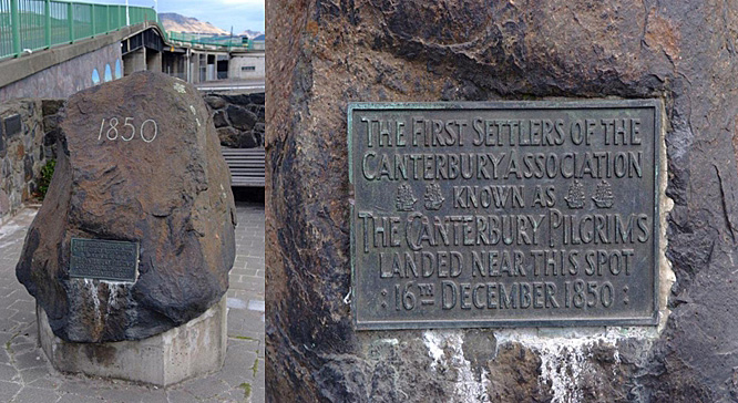
By December 1850 a rough track named Bridle Path had been completed over the hill to the Heathcote valley. Its completion was timely, as the four ships containing the Canterbury Association settlers, the Charlotte Jane, the Randolph, the Sir George Seymour and the Cressy, all arrived between 16 and 27 December 1850. These ‘First Four Ships' brought 773 colonists, temporarily bringing the population of Lyttelton to about 1,100 by New Year's Day 1851. This put pressure on the fledgling township, as there were not enough houses ready for the new arrivals, the barracks could cater for only 300 people and tents had to be erected.
Emigrants who had paid the minimum price of £150 prior to sailing from England were given a land order that corresponded to the order in which their name was drawn in a ballot of all purchasers. The £150 bought 50 rural acres and either half an acre in Christchurch or quarter of an acre in Lyttelton. The fact that some still chose the lesser acreage in Lyttelton shows the faith they had that the port town would be more prosperous than the capital town. Copies of Edward Jollie's map of Lyttelton were thoroughly scrutinised by immigrants from the moment they arrived in the settlement. Those sections in the very centre of Lyttelton town were the most sought after, though mostly as a speculative exercise since most order holders intended to reside on larger rural properties. Indeed, many of the immigrants were domiciled in Lyttelton for only six weeks before they continued over the Bridle Path to Christchurch where they set up home. After those with Lyttelton land orders had made their selections, the remaining town sections were offered for sale. The first town section sold this way appears to have been section number 45 in London Street, to John Grubb, a carpenter and boat builder, who had arrived in Lyttelton in 1849.
The Canterbury Association Land Settlement Act of 1850 had vested some 2.5 million acres of land in Canterbury in the Canterbury Association, some of which had been included in the Kemp purchase. On 7 August 1851 the Canterbury Association Amendment Act was passed, which proved to be a source of later contention as it did not provide for the protection of Ngai Tahu interests derived from unfulfilled promises of the Crown under Kemp's Purchase.
The immigrants soon began to erect structures that were more ambitious than the temporary ones already in existence. Some were of cob or sod but most of the buildings were of timber. Another 15 immigrant ships arrived at Lyttelton during 1851, bringing over 3,000 settlers as well as sheep and cattle. Some notable Canterbury architects arrived and had their early commissions in Lyttelton (for example, Benjamin Woolfield Mountfort and Samuel Charles Farr).
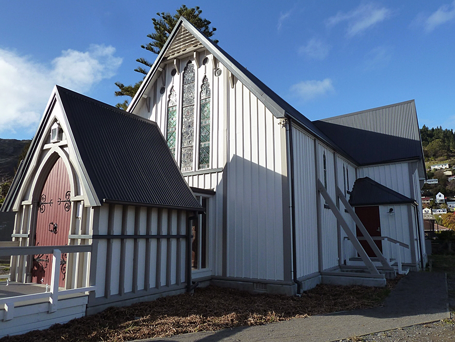
Despite the Canterbury Association's notions of being a Church of England Settlement, it was some time before any recognisable ecclesiastical buildings were constructed in Lyttelton. It was also evident that people of many denominations had inhabited Lyttelton from the outset. Licensed premises, on the other hand, were aplenty. Masonic Lodges and other lodges including Friendly Societies were also established. The Freemasons' Unanimity Lodge No 3 first met in Lyttelton in 1851 and other lodges were established, making up a relatively large number of lodges for a small town.
Typical of New Zealand at this time, the public realm of Lyttelton was a male-dominated one while the domain of women was predominantly in the role as homemaker and colonial ‘helpmeet', with the church being part of the shared public domain. As with other ‘frontier' societies, boundaries for acceptability of daily activities for women were extended and many 19th century Lyttelton women lived practical energetic lives not always in tune with ideals about women's proper place. Middle-class as well as working class women were engaged in a relentless round of domestic toil including, for example, fetching and carrying water up Lyttelton's steep streets. A number of self-proclaimed ‘respectable' women were in employment or ran businesses. Like ports worldwide, prostitution has been an occupation for some women in Lyttelton ever since early in the township's history.
By 1853, self-government of some form seemed assured and the Canterbury Association was dissolved. Although Christchurch had been designated the chief town of the Canterbury settlement, Lyttelton remained the more important centre until the end of the 1850s - it had the first newspaper (the Lyttelton Times), bank, the chief post office, the custom house, a gaol, the only hospital, the immigration barracks, and the offices and warehouses of Canterbury's first merchants. Churches were eventually built and lodges expanded. Cemeteries were separated by denomination (the Anglican Cemetery was laid out on Canterbury Street, while the Roman Catholic and Dissenters cemetery is on the township's western hill). As well as the hotels, tea rooms and boarding houses were built. The port area expanded and ship building facilities were constructed.
Communication with Christchurch was difficult. The Bridle Path over the Port Hills was cut for pack horses and pedestrian traffic, and alternative transport was provided by sea via the Heathcote Estuary. A road via Evans Pass and Sumner was finally completed in 1857 (after work first started in 1849), although it was unsuitable for heavy traffic. The cost and long delays in building this road, intended to be the main connecting route to the Canterbury Plains, was a source of irritation of officials and settlers alike.
In 1857 a building programme for the gaol was drawn up. Over the subsequent decades, the Gothic style Lyttelton Gaol on Oxford Street would achieve proportions that were huge by the standards of a small town.
In 1858 the name of the port was officially changed from Port Victoria to Port Lyttelton, although the two names had been interchangeable for several years.
Lyttelton Municipal Council and Lyttelton Borough Council (1860s):
By the early 1860s Christchurch became more dominant in commerce and industry. The Lyttelton Municipal Council was established in 1862 to administer certain town affairs. In 1868 full borough status was achieved, and the Lyttelton Borough Council was established.
A telegraph office carrying New Zealand's first regular telegraph service opened in Lyttelton on 1 July 1862. Other public and community facilities were improved in the 1860s. A large timber hospital, built on the west side of the town, opened in October 1863. Its buildings dominated the western part of the town for many years. It was only fully utilised for a relatively short period, as it was superseded by Christchurch's public hospital built in during the 1860s, and was converted to an orphanage by 1873. In 1867 the Colonists' Hall was built on Oxford Street, filling a need for a ‘community centre'.
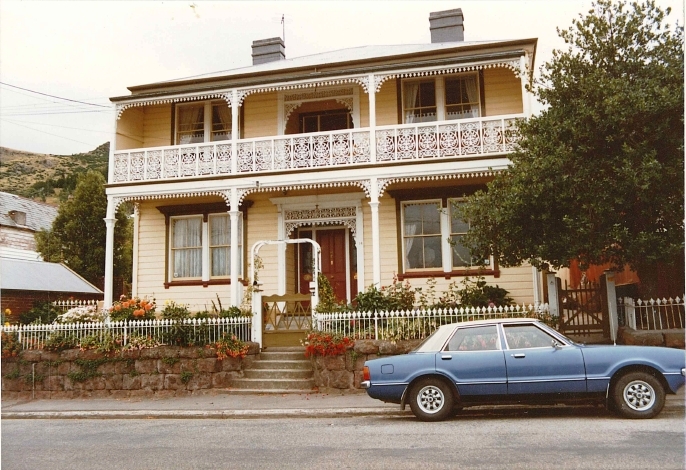
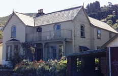
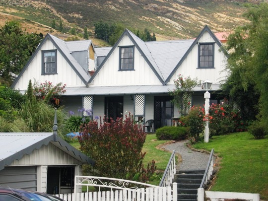
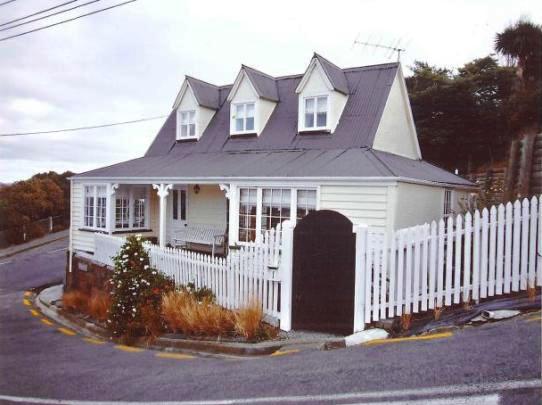
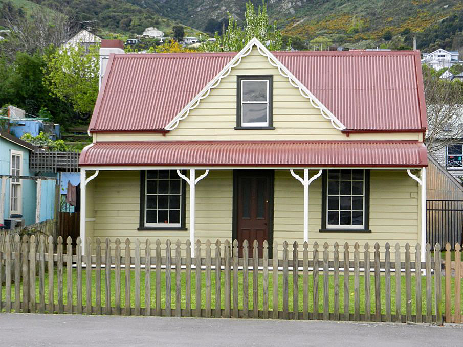
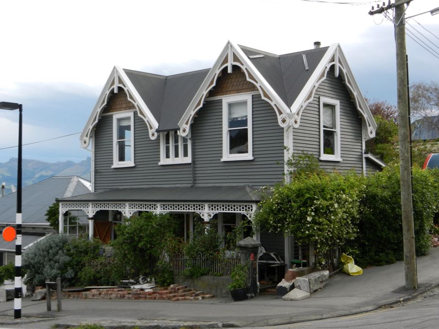
Styles in domestic architecture in Lyttelton did not change dramatically from 1850 to 1870. Cottages of the less affluent were of the ‘But-and-Ben' (two-roomed cottage) or variations on the ‘Saltbox' theme (a two storeyed timber house with a long, pitched roof that slopes down to a single storeyed portion at the back). Houses of wealthier property owners tended to be larger cottages with dormer windows upstairs and verandahs on the ground floor. Narrow one and a half and two storey cottages were ideally suited to the small subdivided sections in Lyttelton. Timber remained the most commonly used construction material irrespective of income.
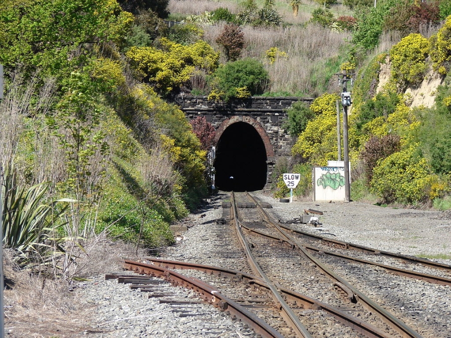
Lyttelton was given a major boost when a decision was made to construct a rail tunnel between Lyttelton and Christchurch. The proposal was for what would be the longest tunnel in the world at that time and the first in the world to be driven through the rim of an extinct volcano. The decision to pursue such a massive engineering project in a relatively remote and sparsely populated part of the world reflects the air of enthusiasm Britain had for rail projects at this time. The rail project drew attention to Lyttelton both nationally and internationally. Ultimately it resulted in further development, and some redevelopment, of the town as the southern portal of the 1.6 kilometre long tunnel emerged in the heart of the town. Lyttelton's rail tunnel, opened in 1867.
It is a common belief that the miners who worked on the tunnel were from Cornwall in England, brought out especially for the tunnel work. Superintendent Moorhouse had engaged a Melbourne engineering firm to carry out the tunnel work after the original contractors had withdrawn but there is no mention of shiploads of Cornish miners being brought in by that firm. Rather, it appears that the Cornish miners were originally employed elsewhere, largely for blasting and clearing work at Officers' and Naval Points, when the breakwaters were being constructed. It is likely that these miners worked on the tunnel after an initial contract for the tunnel work fell over. A list of approximately 100 of the 200 or more tunnel workers compiled in recent years does include names known to be old Celtic Cornish surnames. Whatever their engagement, the Cornish miners' immigration and employment and their surviving dwellings on the road renamed after them (Cornwall Road) is a component in Lyttelton's social history.
The rail tunnel linking Lyttelton and Christchurch was a key element in Canterbury's economic development. New arrivals passed through Lyttelton and new immigration barracks were built in Christchurch. The original Lyttelton immigration barracks site was sold in 1867 and the site was cleared. Nevertheless, Lyttelton continued to grow. By 1868 the population had grown to about 1400 and full borough status was achieved.
When the construction of the railway tunnel began, a spring with a more useful supply of water was tapped (it became known as Tunnel Spring). When the tunnel opened in 1868, a pump was installed to bring water out of the tunnel to the west end of London Street. In 1869 the Borough Council installed four inch pipes to carry the water to tanks on street corners for public use. However, the water supply system (or lack of it) proved to be woefully inadequate in a time of critical need.
1870s - The Fire and Improved Infrastructure:
A disastrous fire occurred in the central business district of Lyttelton on 24 October 1870. Although no-one was killed, six hotels and dozens of shops, stores and houses were destroyed. The lack of adequate water supply to douse the fire was a factor in its spread.
Many of the hotels and downtown trade and retail premises constructed prior to 1870 appear to have had little consideration of fire safety needs. When the fire broke out in the Queen's Hotel on the night of 24 October 1870, it spread rapidly as almost all of the buildings in the centre of town were interconnected or jammed tightly together. The fire raged along the north side of London Street, engulfing the main concentration of the town's buildings, and the west side of Canterbury Street (between London Street and Norwich Quay). The extent of the damage was so great that, although no lives were lost, the fire was regarded at the time as the worst case of property fire since European settlement in New Zealand. More than 75 buildings were destroyed, mostly businesses but in many cases the premises had been adjoined by living quarters. Shelter for those made homeless by the fire was provided in the Colonists' Hall, the hospital, gaol and other available spaces.
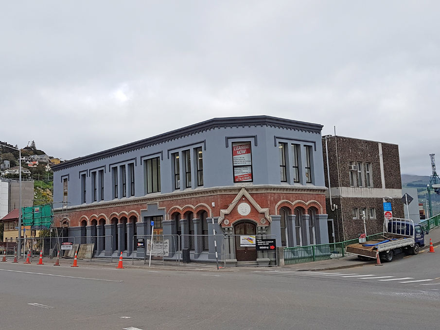
The fire appears to have bankrupted the Lyttelton Borough Council, though they limped on for several years, supervising the process of reconstruction in the downtown area and imposing conditions on rebuilding that were designed to avoid a repeat of the disaster. Requirements that new commercial buildings were to contain more brickwork than their predecessors were idealistic given that many owners could only afford to build simple structures. The pattern of reconstruction and rebuilding was not uniform and for a time there remained a considerable amount of ‘vacant land' as a result of the fire. New materials were used for much of the rebuilding, such as brick and stucco (and some stone) rather than timber. At the same time, local clay from brick fields began to be used on Voelas Road, Hawkhurst Road and Ripon Street for ‘firewalls' between housing. William Armson's stone New Zealand Loan and Mercantile Company on Norwich Quay reflects a new phase of public building.
Despite the fire, it was still a time of prosperity and expansion in Canterbury and most of Lyttelton's main commercial area was quickly rebuilt. The passing of the Public Works Act and Immigration Act in 1870 by the general government impacted on Lyttelton both directly and indirectly. Public facilities were improved, new firms and businesses began to occupy the vacant land created by the fire. A number of building firms, ironmongeries and storage yards were established associated with civic, harbour and domestic works in the town from the 1870s.
A move to set up equal educational opportunities in New Zealand led to the Ordinance Act of 1871. As a result Lyttelton was allocated a state-funded Borough School in 1872, the bulk of its costs of construction coming from the government. The new state school was built immediately next to the gaol as it was the only available space for such a large scale development.
Only a few months after the Borough School opened on 21 January 1875, a newspaper article outlined that extension of the gaol was well underway to redress the problems of overcrowding and intermingling of prisoners. The Lyttelton Gaol grew to be one of the largest in New Zealand. Its hard labour gang built most of the town's stone retaining walls as well as the port's early breakwaters.
Among the new buildings of the 1870s were the Post Office (1876), the Lyttelton Main School (1875), the gasworks (1875), the Casualty Ward, and the Timeball Station (1876). The Timeball Station went into commission in 1876, providing a daily signal by which the vessels in port could set their chronometers. Prison labour was used for the more crude construction work. At the same time the town gas works project was being undertaken under the cliffs adjacent to the Timeball Station and the town's street lighting was converted from kerosene lamps to gas lights. The first mains were laid in 1876. A year later, in October 1877 Lyttelton finally secured a high quality water system.
Improvements to Lyttelton's ‘utilities', community facilities and commercial district in the years between 1875 and 1881 were matched by a ‘boom' in house construction and modification. By 1878 Lyttelton had expanded further to 3,476 people in 626 dwellings.
Late 1870s through to 1890s, including development of harbour and port:
Early in 1877 the Lyttelton Harbour Board was constituted and the harbour facilities were rapidly improved. From its inception through an act of parliament, the Board undertook to bring wharfage facilities into line with the berthage space created by the construction of the harbour breakwaters. Whereas at first the sea came right up against Norwich Quay, later extensive reclamations were made, particularly when the rail tunnel was being built as there was considerable spoil available.
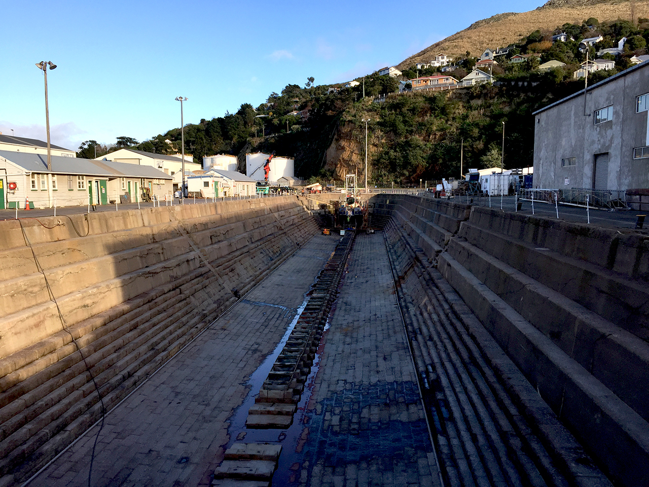
A graving dock was built in 1879-1883, a major project in itself involving some 300 men being employed in various capacities over more than three years.
The 1880s signalled the start of the steam era in the port of Lyttelton. It was also the start of the soot era in Lyttelton, as steamer and rail traffic increased to keep up with trade demands.
Lyttelton's population was 4,127 in 1881. This was the beginning of a decade or more when great quantities of wheat, wool and frozen meat left Lyttelton's shores for distant markets. It was a period when Lyttelton was briefly New Zealand's busiest port, as Dunedin was already in decline. However, Auckland and Wellington soon overtook Lyttelton's rank and trade went to other towns. The consequence was that Lyttelton town did not gain as many public buildings of importance nor did it develop further than it might otherwise have done.
In 1880 the Police Station was built at the foot of Sumner Road and the first Harbour Board offices were built on Norwich Quay. A Sailors' Home built on Norwich Quay was seen at the time as a significant yet increasingly scarce philanthropic act at the time of its opening in 1883. A ships' chandlery was also built around this same time. The Borough Council Chambers were built on the Oxford Street/Sumner Road corner in 1887, and in the same year West Lyttelton School was built on Voelas Road to cope with rapidly increasingly school rolls.
Typical of a number of Victorian towns worldwide, including in Australia, a brick barrel complex for combined storm water and sewage reticulation was installed below the town by the late 19th century.
In 1895 an overnight ferry service from Lyttelton to Wellington heralded the beginning of a vital link in the country's transport network for the next 80 years. Two years later, in 1897, the Lyttelton Borough Council declared the majority of the narrow private roads as public streets within the township.
20th Century Lyttelton:
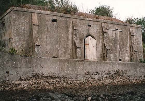
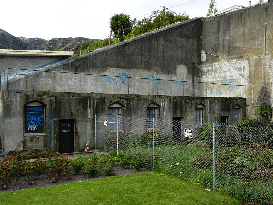
The Edwardian era was a time of booming trade and expansion of population in Lyttelton. It was also a period of high patriotic fervour and pride in being part of the British Empire, with troopers returning from the South African War (1899-1902) being given a large civic welcome at Lyttelton in May 1901. The Lyttelton Harbour was already recognised as being a strategically important harbour (as evidenced by the Ripapa Island fortifications of the 1880s) and further defences were constructed above the Lyttelton township, notably a World War Two Battery.
It was in the early 1900s that Lyttelton became known internationally as the departure point for three British Antarctic expeditions. These were Robert Falcon Scott's first voyage of 1901-4 in Discovery, Shackleton's Nimrod expedition of 1907-08, and Scott's final and ill-fated expedition of 1910-1912. The tragic story of Scott's death deeply affected many people in Lyttelton and Christchurch, as they had followed Britain's Antarctic exploration with great interest. Lyttelton township had the highest population of men who served on Scott and Shackleton's Antarctic explorations than anywhere else in the world. To this day Lyttelton is known as the Antarctic capital of the world and it continues its relationship with Antarctic shipping.
In 1901-2 a combined public library and fire station was built on the corner of Oxford Street and Sumner Road.
In 1913 the national watersider's strike affected Lyttelton, although in contrast to the street battles in Auckland and Wellington, there was very little violence in the town. From 1914 Lyttelton led the way nationally in seeking better pay and safer working conditions on the wharves.
During World War One it became the place of departure of troopships and of return for wounded servicemen. Lyttelton's population grew steadily during the war years, reaching a peak of 4,396 in 1915. The Harbour Light Cinema was built on London Street in 1916-17, providing cinematic entertainment for the community and its visitors. As in other towns throughout New Zealand, Returned Services Association clubrooms were built, Lyttelton's dating from 1924.
The world-wide Spanish influenza epidemic harshly impacted on Lyttelton, as a direct result of spread from arrivals at the port. The town more or less shut down by November 1918. Although few households escaped the epidemic, only 10 actual residents of the town died.
Infrastructure improvements continued in the 20th century. A drainage scheme was inaugurated in 1908, operating by water carriage out to sea in the outer harbour. The water reservoir was renewed and extended and by 1918 there were four additional reservoirs at Lyttelton. Electricity was introduced to Lyttelton from 1919. The electrification of the Christchurch-Lyttelton rail link in 1929 increased visitation from Christchurch dwellers to Lyttelton for weekend outings and it also meant some port workers could live in Christchurch rather than Lyttelton. This probably explains why Lyttelton's population dropped from 3,779 in 1921 to 3,110 two decades later.
The gaol closed in 1920 after a new prison was built at Paparua, west of Christchurch, and Lyttelton's main gaol buildings were demolished in 1922-24. The site was leased to the adjacent school as a playground.
Lyttelton had a number of notable engineering companies, some such as Anderson's engineering works with a presence in Lyttelton as early as 1887. By the 1920s there were more. Toomeys Engineering and Sinclair Melbourne and Co were among those specialising in boilermaking and blacksmithing. Boatbuilding firms and workshops specialised in ship repair.
The Lyttelton Harbour Board continued to develop the inner harbour. Large reclamations, for petroleum storage tanks in the 1920s and the Cashin Quay container berth in 1965, ensured the port's importance. A new container terminal was opened in 1977.
The Depression years of the 1930s brought widespread unemployment. However, during the 1940s Lyttelton was once again a busy place during World War Two. It farewelled troopships at the start of the war and later received home the wounded. A number of military personnel and their families came to live in Lyttelton and temporary barracks were established. This period saw the loss of several Lyttelton landmarks, notably the old Colonists' Hall (demolished 1943), the Godley's house (demolished in 1944 to create a site for the Plunket Society rooms) and the post office's clock tower (taken down in 1944).
Fire continued to be a concern through the 20th century. Most houses had fireplaces heated by coal. A series of fires throughout the 1920s, including a number of shops in London Street, were mostly associated with faulty fireplaces or chimneys. In 1942 another serious fire occurred at Rhinds' Grain Store, destroying also the Lyttelton Hotel and three shops with dwellings on Canterbury Street. These days Lyttelton continues to have a volunteer fire brigade, which operates out of a modern building on London Street after it moved from the Fire Brigade Station and Library Building of 1901-2 on the corner of London and Oxford Streets.
In 1950 the town celebrated its 100th anniversary. According to a survey of occupations undertaken at that time, Lyttelton offered employment to about 850 people (mostly men) in port activities, while another 300 residents worked at shops, trades and the service sector of hotels, tearooms, etc. An estimated 630 of Lyttelton's adult female population were housewives.
Lyttelton joined the national watersiders strike/lockout of 1951. This full scale industrial dispute between the maritime unions and the national government of the time was the longest, most costly and most widespread in New Zealand's history. Lasting 151 days, the bitter industrial dispute set man against man and family against family, but it drew people even closer together within their opposing camps. Many Lytteltonians were still dwelling on those difficult times fifty years on.
Hotels continued to be well patronised throughout the 20th century and at times were a hotbed for unionism.
In 1961 new Harbour Board administrative offices, built as Lyttelton's first high-rise in a modern style of glass and steel were opened on Norwich Quay. A new railway station officially opened in Lyttelton in October 1963. However, it had a limited lifespan, as passenger services to Christchurch were abolished in the early 1970s, a direct result of the opening of a road tunnel in 1964.
In 1955 the growing importance of the port led to statutory authority being granted for the construction of a road tunnel between Lyttelton and Christchurch (the 1951 dispute was cited as emphasising the need for direct road access to Lyttelton from Christchurch). The road tunnel opened on 27 February 1964. The road tunnel had a real impact on both the port and town of Lyttelton. More cargo came by road and people tended to travel by road. The inter-island ferry, which had been used by all types of New Zealanders for 80 years, ceased in 1976. During the 1960s and 1970s Lyttelton got its first high-rise office block, its first supermarket, swimming pool, a new bank, and a modern post office. Some of these developments were directly attributable to the influence of Norman Kirk, Lyttelton's Member of Parliament from 1957 to 1969, who became Prime Minister in 1972.
Lyttelton's population continued to decline slowly, going from 3,589 in the 1956 census to 3,461 in 1976. At least half of Lyttelton's adult males worked in Christchurch and conversely at least half of Lyttelton's watersiders lived in Christchurch. More houses were built and many older timber ones were demolished.
During the mid 20th century, nuclear material had been regularly transported through Lyttelton from Antarctica. However, in 1982 the Lyttelton Borough Council followed Christchurch and Devonport in what would be a series of New Zealand towns, cities and boroughs that would declare themselves ‘nuclear free' and which led to the eventual ban on nuclear ships entering New Zealand ports that remains in place to this day.
The Lyttelton Vintage Homes Club was formed as a community initiative in 1980 in an effort to recognise and preserve old houses of all shapes and sizes in the town.
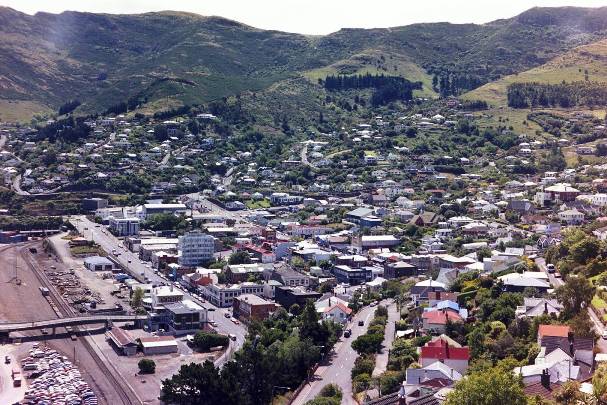
By the end of the 20th century, Lyttelton had become a fashionable place to live. Many early cottages were restored and numerous buildings in the main commercial area were adapted to become cafes and boutiques. Rural farmland surrounding Lyttelton began to be returned to regenerating native bush, delineating the boundary between the township and the volcanic rim even more clearly than in the past when it was farmland. While these changes may mean that the town has lost some of its gritty, working class character, Lyttelton township has retained a high proportion of historic buildings and structures able to tell the story of the workings of the town that has been Canterbury's main port since the province was founded.
In 2006 Banks Peninsula District Council was amalgamated with the Christchurch City Council, ending Lyttelton's independent role in local government. At the time of amalgamation, Lyttelton had 3,075 residents, many of whom commuted to Christchurch to work.